IMAGES TAKEN NEAR TO
Dulverton Garth, LEEDS, LS11 0LH
Introduction
This page details the photographs taken nearby to Dulverton Garth, LS11 0LH by members of the Geograph project.
The Geograph project started in 2005 with the aim of publishing, organising and preserving representative images for every square kilometre of Great Britain, Ireland and the Isle of Man.

There are currently over 7.5m images from over14,400 individuals and you can help contribute to the project by visiting https://www.geograph.org.uk
Image Map
Images are licensed for reuse under creativecommons.org/licenses/by-sa/2.0
Notes
- Clicking on the map will re-center to the selected point.
- The higher the marker number, the further away the image location is from the centre of the postcode.
Image Listing (107 Images Found)
Images are licensed for reuse under creativecommons.org/licenses/by-sa/2.0
Image
Details
Distance
1
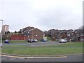
Dulverton Garth - Cottingley Drive
Image: © Betty Longbottom
Taken: 28 Feb 2012
0.01 miles
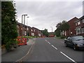
2
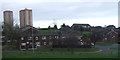
Houses off Cottingley Drive
High rise dwellings beyond.
Image: © JThomas
Taken: 6 Dec 2014
0.03 miles
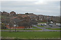
4
Dulverton Square - Cottingley Drive
Image: © Betty Longbottom
Taken: 21 Sep 2009
0.07 miles
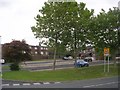
5
Beechcroft View - Cottingley Approach
Image: © Betty Longbottom
Taken: 21 Sep 2009
0.08 miles
6
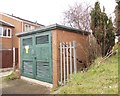
Electricity Substation No 4842 - Cottingley Approach
Image: © Betty Longbottom
Taken: 28 Feb 2012
0.08 miles
7
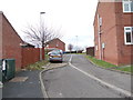
Beechcroft Close - Beechcroft View
Image: © Betty Longbottom
Taken: 28 Feb 2012
0.08 miles
8
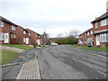
Beechcroft View - Cottingley Approach
Image: © Betty Longbottom
Taken: 28 Feb 2012
0.09 miles
9
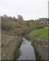
View from Footbridge over Beck - off Marchant Way
Image: © Betty Longbottom
Taken: 7 Nov 2011
0.09 miles
10
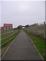
Footpath from Marchant Way to Cottingley Station
Image: © Betty Longbottom
Taken: 7 Nov 2011
0.10 miles