
IMAGES TAKEN NEAR TO
Brown Lane West, LEEDS, LS11 0DN
Introduction
This page details the photographs taken nearby to Brown Lane West, LS11 0DN by members of the Geograph project.
The Geograph project started in 2005 with the aim of publishing, organising and preserving representative images for every square kilometre of Great Britain, Ireland and the Isle of Man.

There are currently over 7.5m images from over14,400 individuals and you can help contribute to the project by visiting https://www.geograph.org.uk
Image Map
Images are licensed for reuse under creativecommons.org/licenses/by-sa/2.0
Notes
- Clicking on the map will re-center to the selected point.
- The higher the marker number, the further away the image location is from the centre of the postcode.
Image Listing (56 Images Found)
Images are licensed for reuse under creativecommons.org/licenses/by-sa/2.0
Image
Details
Distance
1
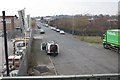
Brown Lane West, Holbeck
Brown Lane was severed by the Ingram Road Distributor (A643) into west and east sections. Here the west section serves an industrial estate alongside Gelderd Road A62, which can be seen at the brick wall in the distance.
Image: © Richard Kay
Taken: 12 Apr 2010
0.03 miles
2
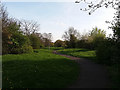
Path over Brown Lane tunnel
Looking the opposite direction from the same spot as Image it's hard to believe that an urban dual carriageway runs only a few metres beneath this oasis of calm. For once the transport planners got something right.
Image: © Stephen Craven
Taken: 4 Apr 2017
0.04 miles
3

Cloverleaf House, Brown Lane West
The building appears to be used by a nursery during the week and a Christian group on Sundays.
Image: © Stephen Craven
Taken: 18 Apr 2017
0.04 miles
4
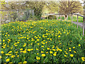
Dandelions over Brown Lane tunnel
Growing in shallow soil on top of an urban dual carriageway, see Image
Image: © Stephen Craven
Taken: 4 Apr 2017
0.05 miles
5
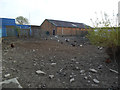
Urban poultry, Brown Lane West
It's not too unusual to see hens being kept even in an urban setting, but I was surprised to see turkeys as well, on this patch of derelict land in an industrial estate in Leeds.
Image: © Stephen Craven
Taken: 18 Apr 2017
0.05 miles
6
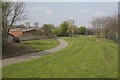
Footpath along the roof of Matthew Murray Tunnel
A pleasantly landscaped footpath directly over 4 lanes of traffic, passing through Matthew Murray Tunnel Image The fence on the left surmounts the west wall of the tunnel which is exposed - see photo Image The tunnel was constructed to shield the nearby Matthew Murray School Image from the busy Ingram Road Distributor.
Image: © Richard Kay
Taken: 12 Apr 2010
0.06 miles
7
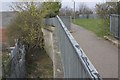
Matthew Murray Tunnel, Outer Wall
The outer wall of the tunnel Image is visible along the west side where it abuts an industrial estate. The tree growth must make access for inspection difficult.
Image: © Richard Kay
Taken: 12 Apr 2010
0.06 miles
8
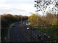
A643 from Brown Lane bridge
Looking north from a bridge or more accurately the northern portal of the short tunnel on the A643 between the M621 and Leeds inner ring road. In the evening peak (as seen here) there is much more traffic heading south (out of the city centre) than north.
Image: © Stephen Craven
Taken: 4 Apr 2017
0.07 miles
9
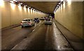
A643 Ingram Distributor Road Tunnel
The A643 Elland Road is regarded locally as a part of the Leeds Inner Ring Road and runs south west from the city through Morley, Cleckheaton, Gomersall and Brighouse to terminate west of Huddersfield at junction 23 of the M62 (Trans Pennine Motorway).
Image: © Steve Partridge
Taken: 5 Dec 2007
0.07 miles
10
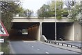
Matthew Murray Tunnel, A643
The south portal of the tunnel, which takes its name from the now demolished Matthew Murray School. The tunnel was built specifically to shield the school from the intrusion and noise of the Ingram Road Distributor, A643, which feeds traffic from the M621 Motorway into the city centre of Leeds.
Image: © Richard Kay
Taken: 12 Apr 2010
0.08 miles