IMAGES TAKEN NEAR TO
Recreation Row, LEEDS, LS11 0AL
Introduction
This page details the photographs taken nearby to Recreation Row, LS11 0AL by members of the Geograph project.
The Geograph project started in 2005 with the aim of publishing, organising and preserving representative images for every square kilometre of Great Britain, Ireland and the Isle of Man.

There are currently over 7.5m images from over14,400 individuals and you can help contribute to the project by visiting https://www.geograph.org.uk
Image Map (Loading...)


Getting Data...Please wait
Leaflet Map data © OpenStreetMap
Images are licensed for reuse under creativecommons.org/licenses/by-sa/2.0
Notes
- Clicking on the map will re-center to the selected point.
- The higher the marker number, the further away the image location is from the centre of the postcode.
Image Listing (289 Images Found)
Images are licensed for reuse under creativecommons.org/licenses/by-sa/2.0
Image
Details
Distance
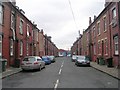
2
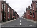
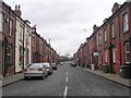
Recreation Terrace - Cleveleys Avenue
Image: © Betty Longbottom
Taken: 16 Feb 2009
0.02 miles
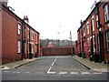
3
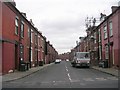
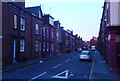
Recreation Place - Cleveleys Avenue
Image: © Betty Longbottom
Taken: 16 Feb 2009
0.02 miles
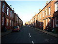
6
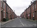
Cleveleys Terrace - Cleveleys Road
Image: © Betty Longbottom
Taken: 16 Feb 2009
0.03 miles
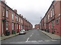
10
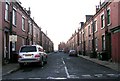
Brown Lane East.
Holbeck. Looking from the junction with Domestic Street.
Image: © Steve Partridge
Taken: 10 Dec 2006
0.03 miles