IMAGES TAKEN NEAR TO
Glade Walk, LEEDS, LS10 4GU
Introduction
This page details the photographs taken nearby to Glade Walk, LS10 4GU by members of the Geograph project.
The Geograph project started in 2005 with the aim of publishing, organising and preserving representative images for every square kilometre of Great Britain, Ireland and the Isle of Man.

There are currently over 7.5m images from over14,400 individuals and you can help contribute to the project by visiting https://www.geograph.org.uk
Image Map
Images are licensed for reuse under creativecommons.org/licenses/by-sa/2.0
Notes
- Clicking on the map will re-center to the selected point.
- The higher the marker number, the further away the image location is from the centre of the postcode.
Image Listing (58 Images Found)
Images are licensed for reuse under creativecommons.org/licenses/by-sa/2.0
Image
Details
Distance
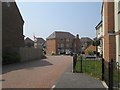
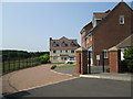
2
Sharp House Road
The homes on the left side form part of the Leeds New Forest Village
Image: © Christine Johnstone
Taken: 5 Apr 2012
0.03 miles
3
Homes in the New Leeds Forest Village
With a fine view across Sharp Lane Plantations.
Image: © Christine Johnstone
Taken: 5 Apr 2012
0.03 miles
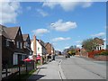
4
Worcester Avenue, off Sharp House Road
Part of a housing development along Sharp Lane, south of Belle Isle.
Image: © Christine Johnstone
Taken: 5 Apr 2012
0.04 miles
5
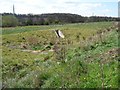
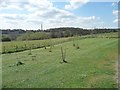
Sustainable drainage system, Sharp Lane Plantations
According to the interpretation panel, in 2009 Leeds City Council, with funding from the Forestry Commission, started developing this multi-functional woodland at the southern boundary of the New Leeds Forest Village housing estate. The woodland has been desinged to incorporate Sustainable Drainage Systems [SUDS], footpaths, bridleways and access controls. it also provides an important green 'jigsaw' link to the other natural areas in south Leeds.
Image: © Christine Johnstone
Taken: 5 Apr 2012
0.04 miles
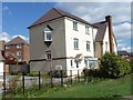
6
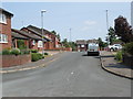
Worcester Avenue - Sharp House Road
Image: © Betty Longbottom
Taken: 5 Jul 2013
0.04 miles
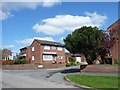
7
Sharp House Place - Sharp House Road
Image: © Betty Longbottom
Taken: 5 Jul 2013
0.04 miles
8
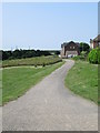
Footpath - Sharp Lane Plantations - Sharp House Road
Image: © Betty Longbottom
Taken: 5 Jul 2013
0.05 miles
9
Sharp Lane Plantations
According to the interpretation panel, in 2009 Leeds City Council, with funding from the Forestry Commission, started developing this multi-functional woodland at the southern boundary of the New Leeds Forest Village housing estate. The woodland has been desinged to incorporate Sustainable Drainage Systems [SUDS], footpaths, bridleways and access controls. it also provides an important green 'jigsaw' link to the other natural areas in south Leeds.
Image: © Christine Johnstone
Taken: 5 Apr 2012
0.05 miles
10
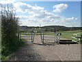
Entrance to Sharp Lane Plantations
According to the interpretation panel, in 2009 Leeds City Council, with funding from the Forestry Commission, started developing this multi-functional woodland at the southern boundary of the New Leeds Forest Village housing estate. The woodland has been desinged to incorporate Sustainable Drainage Systems [SUDS], footpaths, bridleways and access controls. it also provides an important green 'jigsaw' link to the other natural areas in south Leeds.
Image: © Christine Johnstone
Taken: 5 Apr 2012
0.05 miles