IMAGES TAKEN NEAR TO
Manor Farm Rise, LEEDS, LS10 3RF
Introduction
This page details the photographs taken nearby to Manor Farm Rise, LS10 3RF by members of the Geograph project.
The Geograph project started in 2005 with the aim of publishing, organising and preserving representative images for every square kilometre of Great Britain, Ireland and the Isle of Man.

There are currently over 7.5m images from over14,400 individuals and you can help contribute to the project by visiting https://www.geograph.org.uk
Image Map
Images are licensed for reuse under creativecommons.org/licenses/by-sa/2.0
Notes
- Clicking on the map will re-center to the selected point.
- The higher the marker number, the further away the image location is from the centre of the postcode.
Image Listing (60 Images Found)
Images are licensed for reuse under creativecommons.org/licenses/by-sa/2.0
Image
Details
Distance
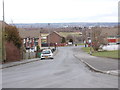
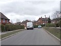
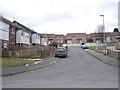
3
Manor Farm Road - viewed from Manor Farm Rise
Image: © Betty Longbottom
Taken: 2 Apr 2013
0.03 miles
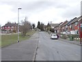
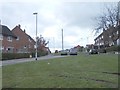
5
Newhall Crescent - viewed from Manor Farm Rise
Image: © Betty Longbottom
Taken: 2 Apr 2013
0.04 miles
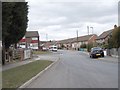
6
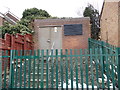
Electricity Substation No 2925 - Manor Farm Road
Image: © Betty Longbottom
Taken: 2 Apr 2013
0.05 miles
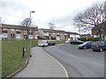
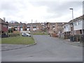
9
Manor Farm Close - Manor Farm Drive
Image: © Betty Longbottom
Taken: 2 Apr 2013
0.10 miles
10
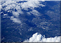
Leeds from the air
Middleton Park is in the foreground. Viewed from a Prague bound flight from Glasgow.
Image: © Thomas Nugent
Taken: 17 Apr 2017
0.12 miles