IMAGES TAKEN NEAR TO
Telford Walk, LEEDS, LS10 2TJ
Introduction
This page details the photographs taken nearby to Telford Walk, LS10 2TJ by members of the Geograph project.
The Geograph project started in 2005 with the aim of publishing, organising and preserving representative images for every square kilometre of Great Britain, Ireland and the Isle of Man.

There are currently over 7.5m images from over14,400 individuals and you can help contribute to the project by visiting https://www.geograph.org.uk
Image Map
Images are licensed for reuse under creativecommons.org/licenses/by-sa/2.0
Notes
- Clicking on the map will re-center to the selected point.
- The higher the marker number, the further away the image location is from the centre of the postcode.
Image Listing (122 Images Found)
Images are licensed for reuse under creativecommons.org/licenses/by-sa/2.0
Image
Details
Distance


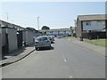
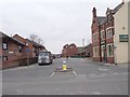
5
Woodhouse Hill Rd - Belle Isle Road
Image: © Betty Longbottom
Taken: 1 Apr 2009
0.05 miles
6
Woodhouse Hill Road - viewed from Balm Road
Image: © Betty Longbottom
Taken: 22 Feb 2013
0.05 miles
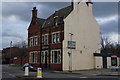

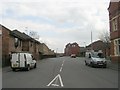
9

The former Railway Inn, Balm Road, Hunslet
Another contributor shows that the building still bore its original name only two years ago Image Now, the only indication of its former identity is the faded inn sign on the main road Image
Image: © Stephen Craven
Taken: 30 Apr 2016
0.06 miles