IMAGES TAKEN NEAR TO
Low Road, LEEDS, LS10 1RA
Introduction
This page details the photographs taken nearby to Low Road, LS10 1RA by members of the Geograph project.
The Geograph project started in 2005 with the aim of publishing, organising and preserving representative images for every square kilometre of Great Britain, Ireland and the Isle of Man.

There are currently over 7.5m images from over14,400 individuals and you can help contribute to the project by visiting https://www.geograph.org.uk
Image Map
Images are licensed for reuse under creativecommons.org/licenses/by-sa/2.0
Notes
- Clicking on the map will re-center to the selected point.
- The higher the marker number, the further away the image location is from the centre of the postcode.
Image Listing (132 Images Found)
Images are licensed for reuse under creativecommons.org/licenses/by-sa/2.0
Image
Details
Distance
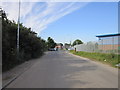
4
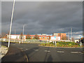
Cummins, Old Mill Lane, Leeds
Distributors of diesel engines.
Image: © Stephen Craven
Taken: 7 Dec 2016
0.04 miles
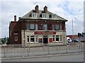
7
Gibraltar Island Road - Old Mill Lane
Image: © Betty Longbottom
Taken: 7 Jun 2013
0.06 miles
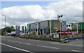
8
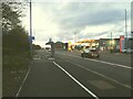
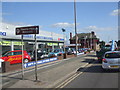
Bus stop, Low Road, Hunslet
For services into the city centre. Note the fairly new segregated cycle lane passing behind the bus stop.
Image: © Stephen Craven
Taken: 2 Apr 2022
0.06 miles
9
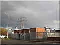
Old Mill Lane substation
Stepping down the voltage from the National Grid overhead lines to urban voltage for underground cables into Leeds.
Image: © Stephen Craven
Taken: 7 Dec 2016
0.06 miles
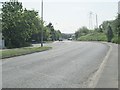
10
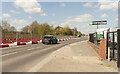
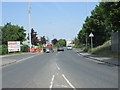
Low Road, Leeds
Looking North West.
Image: © Julian P Guffogg
Taken: 16 Apr 2021
0.07 miles