
IMAGES TAKEN NEAR TO
Wakefield Road, LEEDS, LS10 1FF
Introduction
This page details the photographs taken nearby to Wakefield Road, LS10 1FF by members of the Geograph project.
The Geograph project started in 2005 with the aim of publishing, organising and preserving representative images for every square kilometre of Great Britain, Ireland and the Isle of Man.

There are currently over 7.5m images from over14,400 individuals and you can help contribute to the project by visiting https://www.geograph.org.uk
Image Map
Images are licensed for reuse under creativecommons.org/licenses/by-sa/2.0
Notes
- Clicking on the map will re-center to the selected point.
- The higher the marker number, the further away the image location is from the centre of the postcode.
Image Listing (53 Images Found)
Images are licensed for reuse under creativecommons.org/licenses/by-sa/2.0
Image
Details
Distance
1

Stourton Park and Ride
An overview of this large (5.5 hectare) facility just off the M621, and built in 2021 Image
Image: © Stephen Craven
Taken: 14 Apr 2026
0.02 miles
2
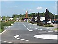
Stourton Park-and-Ride carpark
The site is circular, covering 5 hectares, with the bus station at its centre.
Image: © Stephen Craven
Taken: 9 Sep 2023
0.03 miles
3
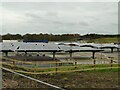
Solar panels in Hunslet
Viewed from the edge of the cemetery, this appears to be part of the recently constructed Stourton Park and Ride site. The solar panels are on the roof of V-shaped shelters but it's not clear what the purpose of this part of the site is: there can't be a need for so many bus stops.
Image: © Stephen Craven
Taken: 21 Feb 2021
0.07 miles
4
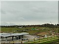
Construction site in Hunslet
Viewed from the edge of the cemetery, this appears to be part of the recently constructed Stourton Park and Ride site that is still being developed.
Image: © Stephen Craven
Taken: 21 Feb 2021
0.09 miles
5
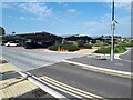
Stourton Park-and-Ride carpark - covered parking
The site is circular, covering 5 hectares. Only the parking spaces in the western quadrant have roofs, in order to provide sufficient solar electricity generation for the site. See also Image taken during construction in 2021.
Image: © Stephen Craven
Taken: 9 Sep 2023
0.09 miles
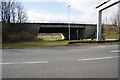
7
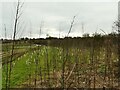
New trees
Planting along the edge of the recently constructed Stourton Park and Ride site.
Image: © Stephen Craven
Taken: 21 Feb 2021
0.12 miles
8
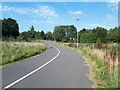
Stourton Park-and-Ride carpark - cycle track
A two-way cycle track was built around the perimeter of the park-and-ride site to give cyclists a traffic-free alternative to the A61. Good, but as so often happens, at the northern end of the site there is a sign to 'city centre' which leads into an area of back-to-back terraced houses with no further direction signage.
Image: © Stephen Craven
Taken: 9 Sep 2023
0.12 miles
9
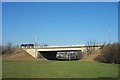
Stourton South Bridge, M621
The M621 was formerly the M1 London to Leeds Motorway but was renumbered after the extension of the M1 to the A1 Trunk Road at Aberford. Built in 1970/71 the bridge is a typical M62 motorway type bridge with inclined face abutments and not the usual M1 motorway type with vertical faces. The bridge is supported on bored pile foundations.
Image: © Richard Kay
Taken: 12 Feb 2008
0.12 miles
10

Young trees at Stourton Park and Ride
Probably planted at the same time as the P&R facility was built (2021).A nice mix of deciduous and evergreen species.
Image: © Stephen Craven
Taken: 14 Apr 2026
0.12 miles