IMAGES TAKEN NEAR TO
Hemingby, HORNCASTLE, LN9 5QJ
Introduction
This page details the photographs taken nearby to LN9 5QJ by members of the Geograph project.
The Geograph project started in 2005 with the aim of publishing, organising and preserving representative images for every square kilometre of Great Britain, Ireland and the Isle of Man.

There are currently over 7.5m images from over14,400 individuals and you can help contribute to the project by visiting https://www.geograph.org.uk
Image Map
Images are licensed for reuse under creativecommons.org/licenses/by-sa/2.0
Notes
- Clicking on the map will re-center to the selected point.
- The higher the marker number, the further away the image location is from the centre of the postcode.
Image Listing (14 Images Found)
Images are licensed for reuse under creativecommons.org/licenses/by-sa/2.0
Image
Details
Distance
1
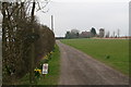
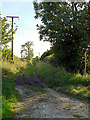
Path to Asterby Top Farm
The house used to consist of a pair of semi-detached farm cottages. Water supply was from a well, but was not drinkable, so visitors were asked by one former occupant to bring bottles of drinking water with them!
Image: © Chris
Taken: 27 Mar 2014
0.02 miles
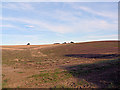
3
Cropmarks on field at Asterby, with Scamblesby above: aerial 2021
Image: © Chris
Taken: 24 Apr 2021
0.20 miles
5
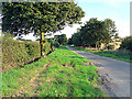
Raynard's Lane
Bridleway to Asterby Top Farm
Image: © Ian Carrington
Taken: 9 Aug 2007
0.21 miles
7
Home Through The Hedge
Hedgerow under restoration on Green Lane. The preserved WWII Chain Home radar mast at ex-RAF Stenigot Image can just be seen on the centre horizon.
Image: © Ian Carrington
Taken: 24 May 2007
0.22 miles
8
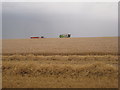
Harvesting until the last minute near Woldale Farm
The grey behind the harvester is a wall of rain which hit about two minutes after I took this photograph. This farmer was determined to keep going until the last minute as he knows, no doubt, that the weather forecast for the next few days is unsettled and he is unlikely to get anymore harvesting done for a while.
Image: © Jonathan Thacker
Taken: 21 Aug 2012
0.22 miles
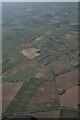
9
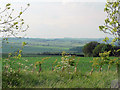
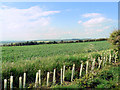
Wolds View
Looking NW from Green Lane near the Goulceby road junction
Image: © Ian Carrington
Taken: 24 May 2007
0.22 miles
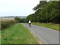
10
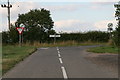
Green Lane's end: the junction with the road to Goulceby
Image: © Chris
Taken: 21 Aug 2013
0.23 miles