IMAGES TAKEN NEAR TO
Hemingby, HORNCASTLE, LN9 5QE
Introduction
This page details the photographs taken nearby to LN9 5QE by members of the Geograph project.
The Geograph project started in 2005 with the aim of publishing, organising and preserving representative images for every square kilometre of Great Britain, Ireland and the Isle of Man.

There are currently over 7.5m images from over14,400 individuals and you can help contribute to the project by visiting https://www.geograph.org.uk
Image Map
Images are licensed for reuse under creativecommons.org/licenses/by-sa/2.0
Notes
- Clicking on the map will re-center to the selected point.
- The higher the marker number, the further away the image location is from the centre of the postcode.
Image Listing (24 Images Found)
Images are licensed for reuse under creativecommons.org/licenses/by-sa/2.0
Image
Details
Distance
2
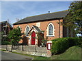
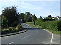
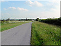
Chapel Lane, Hemingby
View east along Chapel Lane.
Image: © David P Howard
Taken: 28 Feb 2015
0.14 miles
3
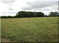
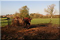
Grass field near Cade's Corner
Just visible is part of a herd of Lincoln Red cattle https://en.wikipedia.org/wiki/Lincoln_Red
Image: © Jonathan Thacker
Taken: 6 Jul 2022
0.14 miles
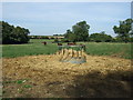
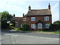
5
Happy event at Cade's Corner
Lincoln Red cow and well camouflaged calf.
Image: © Chris
Taken: 12 Nov 2013
0.15 miles
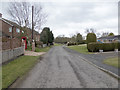
8
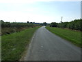
Green Lane towards Hemingby
Heading south west.
Image: © JThomas
Taken: 28 Sep 2013
0.18 miles
10
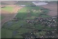
Hemingby and River Bain: aerial 2024
Top: Horncastle's flood alleviation reservoir: see Image
Image: © Chris
Taken: 7 Jan 2024
0.18 miles