1
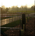
Oak Tree Meadow
It would be funny, if it were not so sad, to see how attempts are made to soften the encroachment of the countryside by modern housing, by giving the developments twee rustic-sounding names.
Image: © Oliver Dixon
Taken: 7 Oct 2012
0.01 miles
2
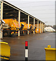
Council Highways depot
Fleet of gritting lorries in their stable.
Image: © Kate Nicol
Taken: 5 Feb 2010
0.02 miles
3
Salt Mountain
Heap of salt for road treatment at the Council depot on Hemingby Lane.
Image: © Kate Nicol
Taken: 5 Feb 2010
0.03 miles
4
Ready for the winter
A heap of salt on the right and gritters prepared.
Image: © Jonathan Thacker
Taken: 13 Oct 2011
0.05 miles
5
Council Highways Depot, Hemingsby Lane, Horncastle
Mountains of road salt under wraps waiting for the onset of winter.
Image: © Oliver Dixon
Taken: 7 Oct 2012
0.06 miles
6
Riddel Skip Hire & Scrap Metal Merchants, Horncastle
Coppers for copper.
Image: © Dave Hitchborne
Taken: 2 Aug 2007
0.08 miles
7
The River Bain, Horncastle
I can't believe this used to be my favourite fishing spot on the river. The bank was overgrown with elderberry and other small trees and nearby poplars. The weeds grew high and provided a perfect backdrop and windbreak.
Image: © Dave Hitchborne
Taken: 5 Nov 2007
0.10 miles
8
Bain Valley Park
This new community park is due to open in Spring 2010. The District Council was awarded £850,000 by East Midlands Development Agency to transform this disused wasteland on the outskirts of Horncastle into parkland. The name was chosen by residents through a ballot.
The development includes a grassed open space for community events edged with a seating wall, landscaping, viewing platforms, footpaths, cycle ways and disabled car parking facilities.
The park will also provide a link between Hemingby Lane and the new Bell's Yard development off the Louth Road.
Image: © Kate Nicol
Taken: 5 Feb 2010
0.16 miles
9
Putting the horns into Horncastle
Looking West from Hemingby Lane
Image: © Kate Nicol
Taken: 5 Feb 2010
0.17 miles
10
Little Pit, Horncastle
I've always known this secluded fishing pond as the Little Pit. I fished it many times in the past, but never thought that one day it would have houses up to the water's edge. The River Bain runs close by.
Image: © Dave Hitchborne
Taken: 2 Aug 2007
0.20 miles


