IMAGES TAKEN NEAR TO
Baumber, HORNCASTLE, LN9 5PE
Introduction
This page details the photographs taken nearby to LN9 5PE by members of the Geograph project.
The Geograph project started in 2005 with the aim of publishing, organising and preserving representative images for every square kilometre of Great Britain, Ireland and the Isle of Man.

There are currently over 7.5m images from over14,400 individuals and you can help contribute to the project by visiting https://www.geograph.org.uk
Image Map
Images are licensed for reuse under creativecommons.org/licenses/by-sa/2.0
Notes
- Clicking on the map will re-center to the selected point.
- The higher the marker number, the further away the image location is from the centre of the postcode.
Image Listing (5 Images Found)
Images are licensed for reuse under creativecommons.org/licenses/by-sa/2.0
Image
Details
Distance
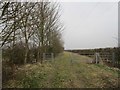
3
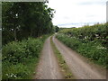
Young hedge plants and trees alongside the Mere Balk Lane bridleway
Rather unnaturally varied collection but some lovely plants ranging from dogwood, hazel and viburnum to cherry-plum, oak and what looked like small-leaved lime.
Image: © Chris
Taken: 19 Jun 2014
0.15 miles
4
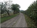
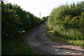
Mere Balk Lane
A short section has been gated at each end to prevent unauthorised access by motor vehicles.
Image: © Jonathan Thacker
Taken: 18 Mar 2015
0.15 miles