IMAGES TAKEN NEAR TO
Drigh Road, MARKET RASEN, LN8 6EE
Introduction
This page details the photographs taken nearby to Drigh Road, LN8 6EE by members of the Geograph project.
The Geograph project started in 2005 with the aim of publishing, organising and preserving representative images for every square kilometre of Great Britain, Ireland and the Isle of Man.

There are currently over 7.5m images from over14,400 individuals and you can help contribute to the project by visiting https://www.geograph.org.uk
Image Map
Images are licensed for reuse under creativecommons.org/licenses/by-sa/2.0
Notes
- Clicking on the map will re-center to the selected point.
- The higher the marker number, the further away the image location is from the centre of the postcode.
Image Listing (36 Images Found)
Images are licensed for reuse under creativecommons.org/licenses/by-sa/2.0
Image
Details
Distance
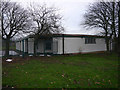
3
NEW
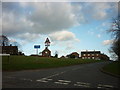
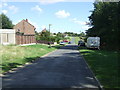
Access road to Binbrook Technical Park
Image: © David Brown
Taken: 13 Mar 2025
0.13 miles
4
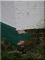
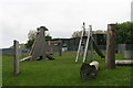
Cut Mark: Binbrook Airfield, Gatehouse
Cut bench mark on the south-west angle of the former gatehouse of the RAF bin brook, now a trading estate. See http://www.geograph.org.uk/photo/4758093 for a wider view and http://www.bench-marks.org.uk/bm71960 for details of the mark.
Image: © Brian Westlake
Taken: 3 Dec 2015
0.16 miles
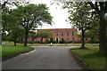
5
Former gatehouse of RAF Binbrook
The nearest angle carries a cut bench mark. See http://www.geograph.org.uk/photo/4758089 for a close-up and http://www.bench-marks.org.uk/bm71960 for details of the mark. RAF Binbrook site is now a trading estate.
Image: © Brian Westlake
Taken: 3 Dec 2015
0.16 miles
6
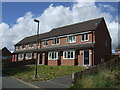
Former R.A.F. Binbrook (Brookenby)
Now a mixed estate consisting of various grades of housing and industrial units.
There are many green areas, varying in their standard of maintenance, and still many cleared areas and old buildings awaiting redevelopment.
Image: © Chris
Taken: 5 Jun 2013
0.16 miles
7
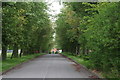
Former R.A.F. Binbrook (Brookenby)
Avenue of whitebeam trees at one of the entrances.
Former R.A.F Binbrook ("Brookenby") is now a mixed estate consisting of various grades of housing and industrial units.
Image: © Chris
Taken: 5 Jun 2013
0.16 miles
8
The new trading estate at the former RAF Binbrook
Image: © Ian S
Taken: 28 Dec 2011
0.17 miles
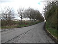
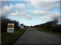
9
Swinhope Road, Brookenby
Heading north east.
Image: © JThomas
Taken: 28 Aug 2015
0.17 miles
10
Big bird at Binbrook
This is one of the last birds based at former R.A.F. Binbrook!
Binbrook is now a mixed estate (named Brookenby) consisting of various grades of housing and industrial units.
There are many green areas, varying in their standard of maintenance, and still many cleared areas and old buildings awaiting redevelopment.
Image: © Chris
Taken: 5 Jun 2013
0.17 miles