IMAGES TAKEN NEAR TO
Fonaby, MARKET RASEN, LN7 6RU
Introduction
This page details the photographs taken nearby to LN7 6RU by members of the Geograph project.
The Geograph project started in 2005 with the aim of publishing, organising and preserving representative images for every square kilometre of Great Britain, Ireland and the Isle of Man.

There are currently over 7.5m images from over14,400 individuals and you can help contribute to the project by visiting https://www.geograph.org.uk
Image Map (Loading...)


Getting Data...Please wait
Leaflet Map data © OpenStreetMap
Images are licensed for reuse under creativecommons.org/licenses/by-sa/2.0
Notes
- Clicking on the map will re-center to the selected point.
- The higher the marker number, the further away the image location is from the centre of the postcode.
Image Listing (14 Images Found)
Images are licensed for reuse under creativecommons.org/licenses/by-sa/2.0
Image
Details
Distance
1
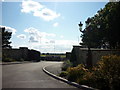
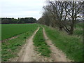
The entrance to Wold Retreat, north of Caistor
Image: © Ian S
Taken: 28 Aug 2011
0.08 miles
2
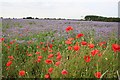
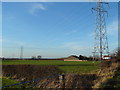
Fonaby view
Farmland off Brigg Road at Fonaby
Image: © Richard Croft
Taken: 19 Jul 2007
0.15 miles


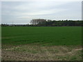
10
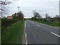
Brigg Road (A1084), Fonaby
Heading north west.
Image: © JThomas
Taken: 12 Apr 2014
0.24 miles