IMAGES TAKEN NEAR TO
Main Street, MARKET RASEN, LN7 6LE
Introduction
This page details the photographs taken nearby to Main Street, LN7 6LE by members of the Geograph project.
The Geograph project started in 2005 with the aim of publishing, organising and preserving representative images for every square kilometre of Great Britain, Ireland and the Isle of Man.

There are currently over 7.5m images from over14,400 individuals and you can help contribute to the project by visiting https://www.geograph.org.uk
Image Map
Images are licensed for reuse under creativecommons.org/licenses/by-sa/2.0
Notes
- Clicking on the map will re-center to the selected point.
- The higher the marker number, the further away the image location is from the centre of the postcode.
Image Listing (12 Images Found)
Images are licensed for reuse under creativecommons.org/licenses/by-sa/2.0
Image
Details
Distance
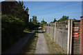
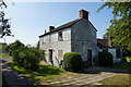
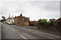
2
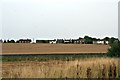
Main Street, Howsham, across the railway from the bridleway from Somerby
Image: © Chris
Taken: 31 Aug 2015
0.02 miles
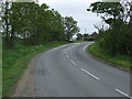
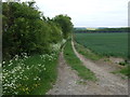
5
Bridleway comes out onto the B1434 at Howsham
Image: © Ian S
Taken: 13 Jun 2018
0.13 miles