
IMAGES TAKEN NEAR TO
The Steadings, LINCOLN, LN6 9DZ
Introduction
This page details the photographs taken nearby to The Steadings, LN6 9DZ by members of the Geograph project.
The Geograph project started in 2005 with the aim of publishing, organising and preserving representative images for every square kilometre of Great Britain, Ireland and the Isle of Man.

There are currently over 7.5m images from over14,400 individuals and you can help contribute to the project by visiting https://www.geograph.org.uk
Image Map
Images are licensed for reuse under creativecommons.org/licenses/by-sa/2.0
Notes
- Clicking on the map will re-center to the selected point.
- The higher the marker number, the further away the image location is from the centre of the postcode.
Image Listing (65 Images Found)
Images are licensed for reuse under creativecommons.org/licenses/by-sa/2.0
Image
Details
Distance
1
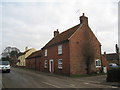
Former farm. Eagle Road, North Scarle
A typical small farmhouse of the district.
Image: © Jonathan Thacker
Taken: 3 Jan 2011
0.03 miles
2
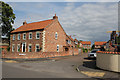
8 Eagle Road, North Scarle
This and the rest of the houses on Eyre's Lane are built in a traditional style.
Image: © Alan Murray-Rust
Taken: 15 Jul 2012
0.04 miles
3
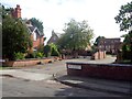
The Steadings
The entrance to a modern housing development. Unusually the street name sign includes the web address of the developer. http://www.fleetman-construction.co.uk/
Image: © Graham Hogg
Taken: 12 Sep 2016
0.04 miles
4
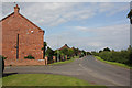
Eagle Road at Wesley Way
20th century housing on the northern side of the village.
Image: © Alan Murray-Rust
Taken: 15 Jul 2012
0.06 miles
5
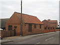
Outbuilding on Eagle Road, North Scarle
Image: © Jonathan Thacker
Taken: 3 Jan 2011
0.06 miles
6
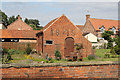
Pear Tree Farm, outbuilding
The date 1846 is prominently displayed in dark brick. Along with the farmhouse http://www.geograph.org.uk/photo/3055019, Listed Grade II.
Image: © Alan Murray-Rust
Taken: 15 Jul 2012
0.07 miles
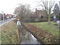
8
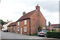
Pear Tree Farmhouse and outbuilding, 2 Eagle Road, North Scarle
Early 19th century Grade II Listed farmhouse with outbuildings.
Image: © Jo and Steve Turner
Taken: 30 Jun 2020
0.07 miles
9
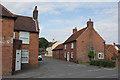
Pear Tree Farmhouse
On the corner of Eagle Road and Swinderby Road. Early 19th century farmhouse with some outbuildings. Listed Grade II.
Image: © Alan Murray-Rust
Taken: 15 Jul 2012
0.07 miles
10
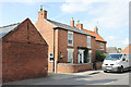
Plum Tree Cottage
Probably early 19th century cottage on Eagle Road. It displays the distinctive local feature of light headers in the brickwork to create a decorative effect.
Image: © Alan Murray-Rust
Taken: 15 Jul 2012
0.08 miles