IMAGES TAKEN NEAR TO
Eton Close, LINCOLN, LN6 0YF
Introduction
This page details the photographs taken nearby to Eton Close, LN6 0YF by members of the Geograph project.
The Geograph project started in 2005 with the aim of publishing, organising and preserving representative images for every square kilometre of Great Britain, Ireland and the Isle of Man.

There are currently over 7.5m images from over14,400 individuals and you can help contribute to the project by visiting https://www.geograph.org.uk
Image Map
Images are licensed for reuse under creativecommons.org/licenses/by-sa/2.0
Notes
- Clicking on the map will re-center to the selected point.
- The higher the marker number, the further away the image location is from the centre of the postcode.
Image Listing (13 Images Found)
Images are licensed for reuse under creativecommons.org/licenses/by-sa/2.0
Image
Details
Distance
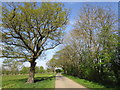
1
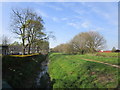
Catchwater Drain
The drain forms the boundary between Lincoln suburbia and agricultural land.
Image: © Jonathan Thacker
Taken: 20 Apr 2019
0.05 miles
2
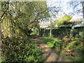
Footpath behind Farrington Crescent
Image: © Jonathan Thacker
Taken: 20 Apr 2019
0.10 miles
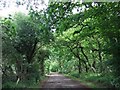
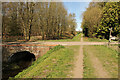
4
Roadway and footpath
The roadway goes to Fen Farm (the notice indicates that the landowners allow its use as a footpath) and the footpath on the right leads to Grosvenor Crescent.
Image: © Jonathan Thacker
Taken: 20 Apr 2019
0.12 miles

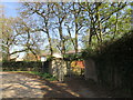
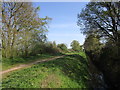
7
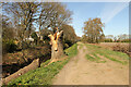
Footpath and Catchwater Drain
Path alongside Catchwater Drain
Image: © Richard Croft
Taken: 13 Apr 2021
0.15 miles
8
Catchwater Drain
Catchwater Drain and footpath near Decoy Farm
Image: © Richard Croft
Taken: 13 Apr 2021
0.15 miles
9
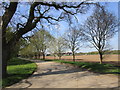
Roadway to Fen Farm
Fen Farm behind the trees. Old Decoy in the distance on the right.
Image: © Jonathan Thacker
Taken: 20 Apr 2019
0.16 miles
10
Catchwater Drain
The drain forms the boundary between Lincoln suburbia and agricultural land.
Image: © Jonathan Thacker
Taken: 20 Apr 2019
0.16 miles