IMAGES TAKEN NEAR TO
Lincoln Drive, LINCOLN, LN5 9NH
Introduction
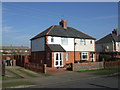
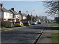
This page details the photographs taken nearby to Lincoln Drive, LN5 9NH by members of the Geograph project.
The Geograph project started in 2005 with the aim of publishing, organising and preserving representative images for every square kilometre of Great Britain, Ireland and the Isle of Man.

There are currently over 7.5m images from over14,400 individuals and you can help contribute to the project by visiting https://www.geograph.org.uk
Image Map
Images are licensed for reuse under creativecommons.org/licenses/by-sa/2.0
Notes
- Clicking on the map will re-center to the selected point.
- The higher the marker number, the further away the image location is from the centre of the postcode.
Image Listing (4 Images Found)
Images are licensed for reuse under creativecommons.org/licenses/by-sa/2.0
Image
Details
Distance
1
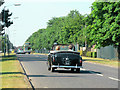
Ermine Street Roman Road
High Dike, Waddington, looking N. Ermine Street north of Image is covered Image by the main runway of RAF Waddington http://www.raf.mod.uk/rafwaddington/ although the line of the old road is preserved in modern day parish boundaries. Here it re-emerges as a public highway where the perimeter fence of the base housing some of the RAF's most sophisticated aircraft runs alongside the road built for Caesar's legions. In a slightly less extreme contrast of ancient and modern, the car is a Hillman Minx cabriolet c. 1954 or 1955.
Image: © Ian Carrington
Taken: 1 Jul 2006
0.09 miles