IMAGES TAKEN NEAR TO
Lowfields, LINCOLN, LN5 0LP
Introduction
This page details the photographs taken nearby to Lowfields, LN5 0LP by members of the Geograph project.
The Geograph project started in 2005 with the aim of publishing, organising and preserving representative images for every square kilometre of Great Britain, Ireland and the Isle of Man.

There are currently over 7.5m images from over14,400 individuals and you can help contribute to the project by visiting https://www.geograph.org.uk
Image Map
Images are licensed for reuse under creativecommons.org/licenses/by-sa/2.0
Notes
- Clicking on the map will re-center to the selected point.
- The higher the marker number, the further away the image location is from the centre of the postcode.
Image Listing (9 Images Found)
Images are licensed for reuse under creativecommons.org/licenses/by-sa/2.0
Image
Details
Distance
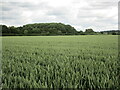
1
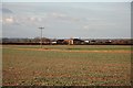
Oak Farm
View to Oak farm from Hooks Lane on Wellingore Low Fields
Image: © Richard Croft
Taken: 22 Nov 2008
0.03 miles
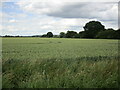
3

Cross Lane
Looking north on Wellingore Low Fields
Image: © Richard Croft
Taken: 22 Nov 2008
0.20 miles
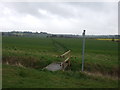

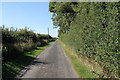
8

Hooks Lane
Wellingore Gorse on the right.
Image: © Jonathan Thacker
Taken: 26 Jun 2023
0.24 miles
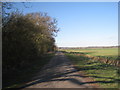
9
Hook's Lane
Running along Wellingore Gorse.
Image: © J.Hannan-Briggs
Taken: 22 Sep 2013
0.24 miles