IMAGES TAKEN NEAR TO
Maidenwell Lane, LINCOLN, LN5 0ED
Introduction
This page details the photographs taken nearby to Maidenwell Lane, LN5 0ED by members of the Geograph project.
The Geograph project started in 2005 with the aim of publishing, organising and preserving representative images for every square kilometre of Great Britain, Ireland and the Isle of Man.

There are currently over 7.5m images from over14,400 individuals and you can help contribute to the project by visiting https://www.geograph.org.uk
Image Map
Images are licensed for reuse under creativecommons.org/licenses/by-sa/2.0
Notes
- Clicking on the map will re-center to the selected point.
- The higher the marker number, the further away the image location is from the centre of the postcode.
Image Listing (104 Images Found)
Images are licensed for reuse under creativecommons.org/licenses/by-sa/2.0
Image
Details
Distance
1

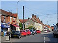
Cut Mark: Navenby, 28 High Street
Cut mark on the angle of the house on High Street. See http://www.bench-marks.org.uk/bm66962 for details of the mark.
Image: © Brian Westlake
Taken: 22 Apr 2015
0.05 miles
2

Navenby - hydrant on High Street
One of several above-ground, lion-head hydrants in Navenby. Richard Croft has supplied photos of another in Navenby (Image) and one in Wellingore (Image). These were manufactured by Glenfield & Kennedy of Kilmarnock (see http://www.firehydrant.org/pictures/glenfield-kennedy.html for more detail of this hydraulic engineering business).
Image: © Dave Bevis
Taken: 9 Jul 2012
0.05 miles
5
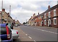
Navenby Village High Street
Navenby is a village 8 miles south of Lincoln. It has a population of approx 1700 and is a dormitory village for Lincoln.
A Bronze Age cemetery has been discovered in the village, as well as the remains of an Iron Age settlement. Historians also believe Navenby was a significant staging point on the Roman Ermine Street, as the Romans are reported to have maintained a small base or garrison in the village. Navenby became a market town after receiving a charter from Edward the Confessor in the 11th century. The charter was later renewed by William Rufus, Edward III and Richard II. When the market fell into disuse in the early 19th century, Navenby returned to being a village http://en.wikipedia.org/wiki/Navenby .
Image: © David Dixon
Taken: 5 Aug 2014
0.07 miles
7

10 Church Lane, Navenby
Seventeenth century cottage https://historicengland.org.uk/listing/the-list/list-entry/1360542?section=official-list-entry
Image: © Jonathan Thacker
Taken: 21 Jun 2023
0.07 miles

9
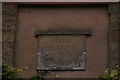
The Benefit Society house, Church Lane, Navenby: detail
Datestone of Image
Image: © Chris
Taken: 23 Oct 2015
0.07 miles
10
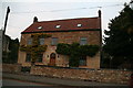
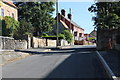
The Benefit Society House, Church Lane, Navenby
See Image for detail.
Image: © Chris
Taken: 23 Oct 2015
0.07 miles