IMAGES TAKEN NEAR TO
Jubilee Way, LINCOLN, LN5 0BF
Introduction
This page details the photographs taken nearby to Jubilee Way, LN5 0BF by members of the Geograph project.
The Geograph project started in 2005 with the aim of publishing, organising and preserving representative images for every square kilometre of Great Britain, Ireland and the Isle of Man.

There are currently over 7.5m images from over14,400 individuals and you can help contribute to the project by visiting https://www.geograph.org.uk
Image Map
Images are licensed for reuse under creativecommons.org/licenses/by-sa/2.0
Notes
- Clicking on the map will re-center to the selected point.
- The higher the marker number, the further away the image location is from the centre of the postcode.
Image Listing (14 Images Found)
Images are licensed for reuse under creativecommons.org/licenses/by-sa/2.0
Image
Details
Distance
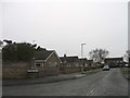
2
Twenty Row
Presumably so named as there are two rows of ten houses
Image: © Richard Croft
Taken: 3 Feb 2007
0.07 miles
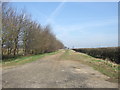
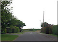
5
High Dyke (Ermine Street)
This section of High Dyke is classified as an unmade road by Lincolnshire County Council.
Image: © Jonathan Thacker
Taken: 21 Oct 2016
0.11 miles
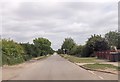
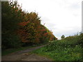
9
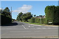
Looking down East Road from High Dike, Navenby
High Dike is actually part of the Roman road, Ermine Street.
Image: © J.Hannan-Briggs
Taken: 22 Sep 2013
0.17 miles