IMAGES TAKEN NEAR TO
Cheetham Lane, LINCOLN, LN4 4QS
Introduction
This page details the photographs taken nearby to Cheetham Lane, LN4 4QS by members of the Geograph project.
The Geograph project started in 2005 with the aim of publishing, organising and preserving representative images for every square kilometre of Great Britain, Ireland and the Isle of Man.

There are currently over 7.5m images from over14,400 individuals and you can help contribute to the project by visiting https://www.geograph.org.uk
Image Map (Loading...)


Getting Data...Please wait
Leaflet Map data © OpenStreetMap
Images are licensed for reuse under creativecommons.org/licenses/by-sa/2.0
Notes
- Clicking on the map will re-center to the selected point.
- The higher the marker number, the further away the image location is from the centre of the postcode.
Image Listing (14 Images Found)
Images are licensed for reuse under creativecommons.org/licenses/by-sa/2.0
Image
Details
Distance
2
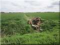
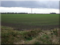
Remains of a tree
The only feature for some distance!
Image: © Jonathan Thacker
Taken: 17 Apr 2015
0.04 miles
3
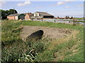
Farm and Pipe Bridge
The huge pipe carries a land drainage ditch under the lane.
Image: © Michael Patterson
Taken: 5 Sep 2006
0.13 miles
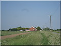
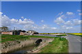
4
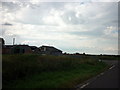
Cheetham's Lane
Fenland lane and Cheetham's Bridge Farm
Image: © Richard Croft
Taken: 6 Feb 2008
0.15 miles
5
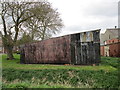
Corrugated iron shed at Cheethams Bridge Farm
Showing several layers of paint.
Image: © Jonathan Thacker
Taken: 17 Apr 2015
0.18 miles
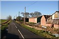
6
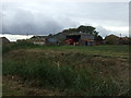
Cheethams Bridge Farm
Off North Forty Foot Bank.
Image: © JThomas
Taken: 18 Oct 2014
0.19 miles
9
Cheethams Bridge Farm
The bridge carries Cheethams Lane over the North Forty Foot Drain
Image: © Tim Heaton
Taken: 3 May 2016
0.20 miles
10
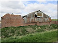
Derelict buildings at Cheethams Bridge Farm
No longer useful.
Image: © Jonathan Thacker
Taken: 17 Apr 2015
0.21 miles