IMAGES TAKEN NEAR TO
Ruskington Fen, LINCOLN, LN4 4DS
Introduction
This page details the photographs taken nearby to Ruskington Fen, LN4 4DS by members of the Geograph project.
The Geograph project started in 2005 with the aim of publishing, organising and preserving representative images for every square kilometre of Great Britain, Ireland and the Isle of Man.

There are currently over 7.5m images from over14,400 individuals and you can help contribute to the project by visiting https://www.geograph.org.uk
Image Map (Loading...)


Getting Data...Please wait
Leaflet Map data © OpenStreetMap
Images are licensed for reuse under creativecommons.org/licenses/by-sa/2.0
Notes
- Clicking on the map will re-center to the selected point.
- The higher the marker number, the further away the image location is from the centre of the postcode.
Image Listing (4 Images Found)
Images are licensed for reuse under creativecommons.org/licenses/by-sa/2.0
Image
Details
Distance
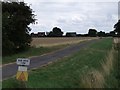
1
Shed near Bank House Farm, Ruskington Fen
Image: © Jonathan Thacker
Taken: 4 May 2015
0.14 miles
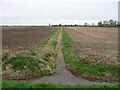
2
The road to Bank House Farm, Ruskington Fen
A warm welcome is extended to all Geographers!
Image: © Alan Murray-Rust
Taken: 29 Apr 2007
0.21 miles