IMAGES TAKEN NEAR TO
Metheringham, LINCOLN, LN4 3BW
Introduction
This page details the photographs taken nearby to LN4 3BW by members of the Geograph project.
The Geograph project started in 2005 with the aim of publishing, organising and preserving representative images for every square kilometre of Great Britain, Ireland and the Isle of Man.

There are currently over 7.5m images from over14,400 individuals and you can help contribute to the project by visiting https://www.geograph.org.uk
Image Map
Images are licensed for reuse under creativecommons.org/licenses/by-sa/2.0
Notes
- Clicking on the map will re-center to the selected point.
- The higher the marker number, the further away the image location is from the centre of the postcode.
Image Listing (8 Images Found)
Images are licensed for reuse under creativecommons.org/licenses/by-sa/2.0
Image
Details
Distance
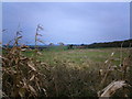
1
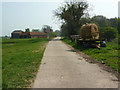
Car Dyke Bank
Permissive path by Car Dyke with Delph End farm
Image: © Richard Croft
Taken: 20 Apr 2011
0.02 miles
2
Metheringham Delph bank
Footpath from Metheringham Delph bank to Car Dyke bank
Image: © Richard Croft
Taken: 20 Apr 2011
0.06 miles
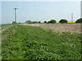
3
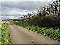
Farm track alongside the Car Dyke
Delph End in the distance.
Image: © Jonathan Thacker
Taken: 17 Mar 2020
0.08 miles
4
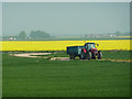
Metheringham Fen
Metheringham Fen near Delph End with houses at Sots Hole in the distance
Image: © Richard Croft
Taken: 20 Apr 2011
0.09 miles
5
Looking North East towards Delph End Farm
From the top of the Barff looking towards the Fen and Metheringham Delph (Drainage channel)
Image: © Jack OHern
Taken: 1 Jan 2006
0.09 miles
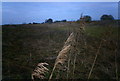
6
Metheringham Delph
Metheringham Delph near the head with Car Dyke, somewhat overgrown with reeds
Image: © Richard Croft
Taken: 20 Apr 2011
0.15 miles
7
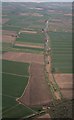
Metheringham Delph, Delph End and the Car Dyke: aerial 2017
See also Image
Image: © Chris
Taken: 25 Mar 2017
0.16 miles
8
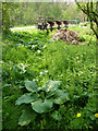
Grasses on Metheringham Delph
Metheringham Delph Nature Reserve
Image: © Jack OHern
Taken: 1 Jan 2006
0.24 miles