IMAGES TAKEN NEAR TO
Council Houses, LINCOLN, LN4 3AJ
Introduction
This page details the photographs taken nearby to Council Houses, LN4 3AJ by members of the Geograph project.
The Geograph project started in 2005 with the aim of publishing, organising and preserving representative images for every square kilometre of Great Britain, Ireland and the Isle of Man.

There are currently over 7.5m images from over14,400 individuals and you can help contribute to the project by visiting https://www.geograph.org.uk
Image Map (Loading...)


Getting Data...Please wait
Leaflet Map data © OpenStreetMap
Images are licensed for reuse under creativecommons.org/licenses/by-sa/2.0
Notes
- Clicking on the map will re-center to the selected point.
- The higher the marker number, the further away the image location is from the centre of the postcode.
Image Listing (11 Images Found)
Images are licensed for reuse under creativecommons.org/licenses/by-sa/2.0
Image
Details
Distance
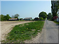
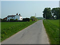
4
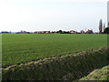
Sots Hole
Looking northwest from the Tanvats road
Image: © Ian Carrington
Taken: 22 Jan 2006
0.06 miles
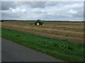
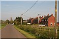
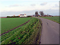
7
Metheringham Fen at Sots Hole
Poplar Farm (in Dunston Fen) on the horizon.
Image: © Jonathan Thacker
Taken: 2 Oct 2019
0.18 miles
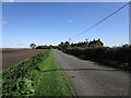
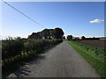
8
Sots Hole
Entering Sots Hole on Metheringham Fen Lane
Image: © Richard Croft
Taken: 20 Apr 2011
0.18 miles
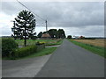
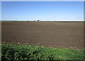
9
Sots Hole
seen from the west on Metheringham Fen Lane
Image: © Ian Carrington
Taken: 22 Jan 2006
0.20 miles