IMAGES TAKEN NEAR TO
Willow Court, LINCOLN, LN4 2RE
Introduction
This page details the photographs taken nearby to Willow Court, LN4 2RE by members of the Geograph project.
The Geograph project started in 2005 with the aim of publishing, organising and preserving representative images for every square kilometre of Great Britain, Ireland and the Isle of Man.

There are currently over 7.5m images from over14,400 individuals and you can help contribute to the project by visiting https://www.geograph.org.uk
Image Map (Loading...)


Getting Data...Please wait
Leaflet Map data © OpenStreetMap
Images are licensed for reuse under creativecommons.org/licenses/by-sa/2.0
Notes
- Clicking on the map will re-center to the selected point.
- The higher the marker number, the further away the image location is from the centre of the postcode.
Image Listing (10 Images Found)
Images are licensed for reuse under creativecommons.org/licenses/by-sa/2.0
Image
Details
Distance
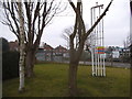
1
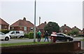
Sleaford Road, Bracebridge Heath
From the Esso petrol station
Image: © David Howard
Taken: 24 Jun 2019
0.11 miles
2
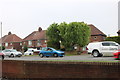
Sleaford Road, Bracebridge Heath
I got petrol and a drink here when I arrived, and dinner on the way back from Cabourne. It turns out, mainly due to its convenient location and cheap petrol I'd done exactly the same when I was there before. https://www.geograph.org.uk/photo/5651472
Image: © David Howard
Taken: 24 Jun 2019
0.12 miles
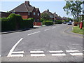
3
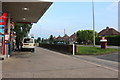
Petrol station on Sleaford Road, Bracebridge Heath
This was my second visit of the day as I was heading back south, and was for my dinner rather than petrol. I was there the first time I was in Lincoln as well last year as it is convenient and the first one for miles northbound.
Image: © David Howard
Taken: 24 Jun 2019
0.12 miles
4
Petrol station forecourt on Sleaford Road
Image: © David Howard
Taken: 13 Jan 2018
0.14 miles
5
Petrol station gardens by Sleaford Road
Image: © David Howard
Taken: 13 Jan 2018
0.14 miles
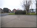
8
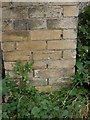
Cut Mark: Bracebridge Heath, Manor House
Cut bench mark on the left-hand gatepost of an entrance to Manor House. See http://www.geograph.org.uk/photo/4192478 for a wider view and http://www.bench-marks.org.uk/bm60776 for details of the mark.
Image: © Brian Westlake
Taken: 30 Sep 2014
0.23 miles
9
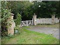
Bracebridge Heath, Manor House entrance
The left-hand gatepost carries a cut bench mark. See http://www.geograph.org.uk/photo/4192470 for a close-up and http://www.bench-marks.org.uk/bm60776 for details of the mark.
Image: © Brian Westlake
Taken: 30 Sep 2014
0.23 miles
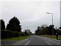
10
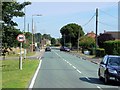
Bracebridge Heath, Grantham Road
The A607 briefly follows the route of the Roman Ermine Street at Bracebridge Heath.
Image: © David Dixon
Taken: 5 Aug 2014
0.24 miles