IMAGES TAKEN NEAR TO
Bracebridge Heath, LINCOLN, LN4 2HY
Introduction
This page details the photographs taken nearby to LN4 2HY by members of the Geograph project.
The Geograph project started in 2005 with the aim of publishing, organising and preserving representative images for every square kilometre of Great Britain, Ireland and the Isle of Man.

There are currently over 7.5m images from over14,400 individuals and you can help contribute to the project by visiting https://www.geograph.org.uk
Image Map
Images are licensed for reuse under creativecommons.org/licenses/by-sa/2.0
Notes
- Clicking on the map will re-center to the selected point.
- The higher the marker number, the further away the image location is from the centre of the postcode.
Image Listing (9 Images Found)
Images are licensed for reuse under creativecommons.org/licenses/by-sa/2.0
Image
Details
Distance
1
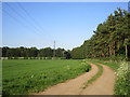
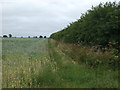
Farm track and footpath to Branston
Image: © Jonathan Thacker
Taken: 14 May 2019
0.09 miles
4
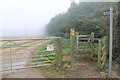
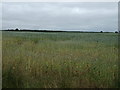
Footpath in the mist, off Bloxholme Lane
Image: © J.Hannan-Briggs
Taken: 13 Oct 2012
0.15 miles
9
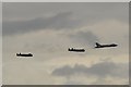
Flypast, Lancaster tour 2014
The Lancasters, seeImage, led by the Vulcan, carried out a flypast for the spectators before heading off to the next venue.
Image: © Mike Kirby
Taken: 21 Aug 2014
0.24 miles