IMAGES TAKEN NEAR TO
Burton Mews, LINCOLN, LN4 1TA
Introduction
This page details the photographs taken nearby to Burton Mews, LN4 1TA by members of the Geograph project.
The Geograph project started in 2005 with the aim of publishing, organising and preserving representative images for every square kilometre of Great Britain, Ireland and the Isle of Man.

There are currently over 7.5m images from over14,400 individuals and you can help contribute to the project by visiting https://www.geograph.org.uk
Image Map
Images are licensed for reuse under creativecommons.org/licenses/by-sa/2.0
Notes
- Clicking on the map will re-center to the selected point.
- The higher the marker number, the further away the image location is from the centre of the postcode.
Image Listing (7 Images Found)
Images are licensed for reuse under creativecommons.org/licenses/by-sa/2.0
Image
Details
Distance
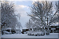
1
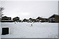
Snow in Yale Close, Washingborough
Image: © Jo and Steve Turner
Taken: 2 Dec 2010
0.11 miles
2
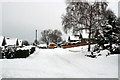
Snow in Cambridge Drive, Washingborough
Image: © Jo and Steve Turner
Taken: 2 Dec 2010
0.12 miles
3
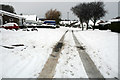
Snow in Marlborough Avenue, Washingborough
Image: © Jo and Steve Turner
Taken: 2 Dec 2010
0.17 miles
4
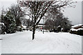
Snow in Leicester Close, Washingborough
Image: © Jo and Steve Turner
Taken: 2 Dec 2010
0.18 miles
5
Snow in Oxford Close Washingborough
Image: © Jo and Steve Turner
Taken: 1 Dec 2010
0.20 miles
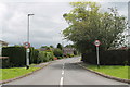
7

The Precinct, Park Lane, Washingborough
I assume the precinct was built during development of the housing estate in the late 1960s or early 1970s. Completed in October 2015, the Lincolnshire Co-op invested about £750,000 in a complete refurbishment of its shops and the precinct area.
Image: © Jo and Steve Turner
Taken: 6 May 2012
0.24 miles