IMAGES TAKEN NEAR TO
Reasby, LINCOLN, LN3 5BW
Introduction
This page details the photographs taken nearby to LN3 5BW by members of the Geograph project.
The Geograph project started in 2005 with the aim of publishing, organising and preserving representative images for every square kilometre of Great Britain, Ireland and the Isle of Man.

There are currently over 7.5m images from over14,400 individuals and you can help contribute to the project by visiting https://www.geograph.org.uk
Image Map
Images are licensed for reuse under creativecommons.org/licenses/by-sa/2.0
Notes
- Clicking on the map will re-center to the selected point.
- The higher the marker number, the further away the image location is from the centre of the postcode.
Image Listing (18 Images Found)
Images are licensed for reuse under creativecommons.org/licenses/by-sa/2.0
Image
Details
Distance
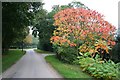
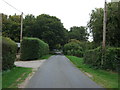
1
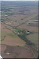
View towards Reasby
Mid August and in this picture at least, harvest is a memory.
Image: © Jonathan Thacker
Taken: 22 Aug 2014
0.02 miles
2
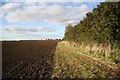
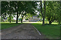
Reasby bridleway
Bridleway to Swinthorpe by Reasby Hall
Image: © Richard Croft
Taken: 5 Oct 2008
0.03 miles
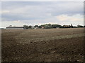
5
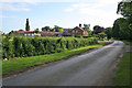
National Cycle Route 1, Reasby
Heading north east.
Image: © JThomas
Taken: 6 Sep 2014
0.05 miles