
IMAGES TAKEN NEAR TO
Ridings Close, LINCOLN, LN3 4FE
Introduction
This page details the photographs taken nearby to Ridings Close, LN3 4FE by members of the Geograph project.
The Geograph project started in 2005 with the aim of publishing, organising and preserving representative images for every square kilometre of Great Britain, Ireland and the Isle of Man.

There are currently over 7.5m images from over14,400 individuals and you can help contribute to the project by visiting https://www.geograph.org.uk
Image Map
Images are licensed for reuse under creativecommons.org/licenses/by-sa/2.0
Notes
- Clicking on the map will re-center to the selected point.
- The higher the marker number, the further away the image location is from the centre of the postcode.
Image Listing (11 Images Found)
Images are licensed for reuse under creativecommons.org/licenses/by-sa/2.0
Image
Details
Distance
1
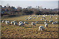
Fiskerton sheep
Sheep grazing in a field off Hall Lane
Image: © Richard Croft
Taken: 21 Jan 2011
0.05 miles
2

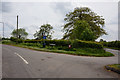
Houses on the north side of Ferry Road, Fiskerton
On the large-scale OS maps revised in both 1938 and 1946 these houses are shown as planned but not yet built.
Image: © Christine Johnstone
Taken: 29 May 2025
0.06 miles
4
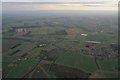
Fiskerton and River Witham on a cold winter day: aerial 2017
Looking across the corner of the disused airfield.
See also Image
Image: © Chris
Taken: 9 Dec 2017
0.10 miles
6
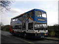
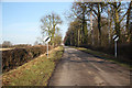
Bus on Ferry Road, Fiskerton
Stagecoach Lincolnshire 16817, a Volvo Olympian/Northern Counties Palatine new to Kingston upon Hull City Transport shortly after its takeover by Stagecoach, stands on Ferry Road on the eastern edge of Fiskerton, working a 15 from Short Ferry to Lincoln.
Image: © Richard Vince
Taken: 12 Mar 2011
0.16 miles
7
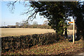
Footpath to Fiskerton
A new wooden fingerpost indicates the footpath from Hall Lane to Fiskerton
Image: © Richard Croft
Taken: 21 Jan 2011
0.17 miles
10
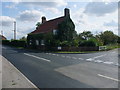
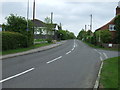
Diamond House
The Viking Way to Lincoln takes the lane off to the top right. The busy main road, Ferry Road, forms part of National Cycle Route #1
Image: © Tim Heaton
Taken: 15 Sep 2011
0.20 miles