IMAGES TAKEN NEAR TO
Ashing Lane, LINCOLN, LN2 3BY
Introduction
This page details the photographs taken nearby to Ashing Lane, LN2 3BY by members of the Geograph project.
The Geograph project started in 2005 with the aim of publishing, organising and preserving representative images for every square kilometre of Great Britain, Ireland and the Isle of Man.

There are currently over 7.5m images from over14,400 individuals and you can help contribute to the project by visiting https://www.geograph.org.uk
Image Map
Images are licensed for reuse under creativecommons.org/licenses/by-sa/2.0
Notes
- Clicking on the map will re-center to the selected point.
- The higher the marker number, the further away the image location is from the centre of the postcode.
Image Listing (11 Images Found)
Images are licensed for reuse under creativecommons.org/licenses/by-sa/2.0
Image
Details
Distance
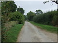
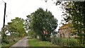
2
A new road by the new development at Ashlin Farm
As this is off Ashing Lane I suspect a typo by the original OS cartographers maybe?
Image: © David Brown
Taken: 11 Sep 2023
0.05 miles
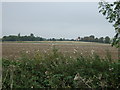

7
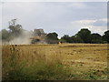
Combine harvester at work
There were three combine harvesters at work in this field.
Image: © Jonathan Thacker
Taken: 22 Aug 2014
0.22 miles
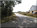
8
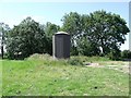
Metal storage shed and woodland on Ashing Lane
Image: © J.Hannan-Briggs
Taken: 24 Jul 2011
0.23 miles
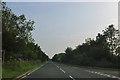
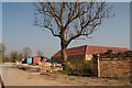
10
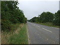
A46 towards Market Rasen
Heading north east on the outskirts of Dunholme.
Image: © JThomas
Taken: 6 Sep 2014
0.24 miles