IMAGES TAKEN NEAR TO
Upper Walk Close, LN2 2ZE
Introduction
This page details the photographs taken nearby to Upper Walk Close, LN2 2ZE by members of the Geograph project.
The Geograph project started in 2005 with the aim of publishing, organising and preserving representative images for every square kilometre of Great Britain, Ireland and the Isle of Man.

There are currently over 7.5m images from over14,400 individuals and you can help contribute to the project by visiting https://www.geograph.org.uk
Image Map (Loading...)


Getting Data...Please wait
Leaflet Map data © OpenStreetMap
Images are licensed for reuse under creativecommons.org/licenses/by-sa/2.0
Notes
- Clicking on the map will re-center to the selected point.
- The higher the marker number, the further away the image location is from the centre of the postcode.
Image Listing (11 Images Found)
Images are licensed for reuse under creativecommons.org/licenses/by-sa/2.0
Image
Details
Distance
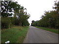
1
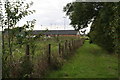
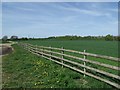
Bridleway westwards from Lodge Lane, Nettleham
Alongside the grounds of Lincoln Rugby Football Club.
Image: © Chris
Taken: 5 Sep 2015
0.13 miles
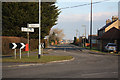
8
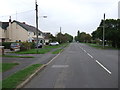
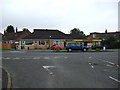
Lodge Lane
Junction of Lodge Lane and Sudbrooke Lane at Nettleham
Image: © Richard Croft
Taken: 21 Jan 2011
0.20 miles
9
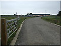
Lodge Lane
Heading south east towards the A158.
Image: © JThomas
Taken: 6 Sep 2014
0.21 miles
10
Sudbrooke Lane
Junction of Lodge Lane and Sudbrooke Lane at Nettleham
Image: © Richard Croft
Taken: 21 Jan 2011
0.22 miles