IMAGES TAKEN NEAR TO
Hagnaby, ALFORD, LN13 9QQ
Introduction
This page details the photographs taken nearby to LN13 9QQ by members of the Geograph project.
The Geograph project started in 2005 with the aim of publishing, organising and preserving representative images for every square kilometre of Great Britain, Ireland and the Isle of Man.

There are currently over 7.5m images from over14,400 individuals and you can help contribute to the project by visiting https://www.geograph.org.uk
Image Map (Loading...)


Getting Data...Please wait
Leaflet Map data © OpenStreetMap
Images are licensed for reuse under creativecommons.org/licenses/by-sa/2.0
Notes
- Clicking on the map will re-center to the selected point.
- The higher the marker number, the further away the image location is from the centre of the postcode.
Image Listing (10 Images Found)
Images are licensed for reuse under creativecommons.org/licenses/by-sa/2.0
Image
Details
Distance
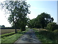
5
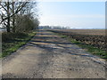
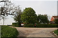
Track to Abbey Farm at Hagnaby
Looking westward.
Image: © Peter Wood
Taken: 24 Feb 2019
0.06 miles
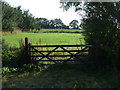
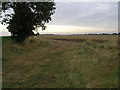
7
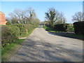
Field edge near Hagnaby
The sign on the tree says Private Property.
Image: © J.Hannan-Briggs
Taken: 24 Nov 2013
0.13 miles
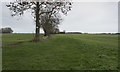
10
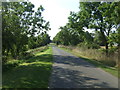
Field and Cloud
The early morning cloud over this field is being burnt off by the rising sun.
Image: © Michael Patterson
Taken: 23 Aug 2006
0.24 miles