IMAGES TAKEN NEAR TO
Mawthorpe, ALFORD, LN13 9LU
Introduction
This page details the photographs taken nearby to LN13 9LU by members of the Geograph project.
The Geograph project started in 2005 with the aim of publishing, organising and preserving representative images for every square kilometre of Great Britain, Ireland and the Isle of Man.

There are currently over 7.5m images from over14,400 individuals and you can help contribute to the project by visiting https://www.geograph.org.uk
Image Map (Loading...)


Getting Data...Please wait
Leaflet Map data © OpenStreetMap
Images are licensed for reuse under creativecommons.org/licenses/by-sa/2.0
Notes
- Clicking on the map will re-center to the selected point.
- The higher the marker number, the further away the image location is from the centre of the postcode.
Image Listing (4 Images Found)
Images are licensed for reuse under creativecommons.org/licenses/by-sa/2.0
Image
Details
Distance
2
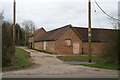
Buildings at Hill Farm
So this is the hill in "Mawthorpe Hill Road". I didn't even notice the incline.
Image: © Chris
Taken: 24 Feb 2014
0.08 miles
3
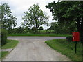
Track to Claxby Grange - with a splash of red
Image: © Chris
Taken: 24 Feb 2014
0.12 miles