IMAGES TAKEN NEAR TO
Cumberworth, ALFORD, LN13 9LQ
Introduction
This page details the photographs taken nearby to LN13 9LQ by members of the Geograph project.
The Geograph project started in 2005 with the aim of publishing, organising and preserving representative images for every square kilometre of Great Britain, Ireland and the Isle of Man.

There are currently over 7.5m images from over14,400 individuals and you can help contribute to the project by visiting https://www.geograph.org.uk
Image Map (Loading...)


Getting Data...Please wait
Leaflet Map data © OpenStreetMap
Images are licensed for reuse under creativecommons.org/licenses/by-sa/2.0
Notes
- Clicking on the map will re-center to the selected point.
- The higher the marker number, the further away the image location is from the centre of the postcode.
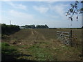
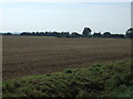
Image Listing (16 Images Found)
Images are licensed for reuse under creativecommons.org/licenses/by-sa/2.0
Image
Details
Distance
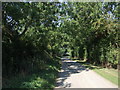
2
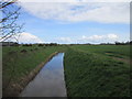
Thorn Holt Bridge
Alford road crosses the Main Drain.
Image: © J.Hannan-Briggs
Taken: 24 Nov 2013
0.05 miles
5
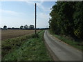
Road towards Field House Farm
Looking west.
Image: © JThomas
Taken: 11 Sep 2015
0.07 miles

10
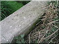
Rivet on a culvert at Cumberworth, Westfield Lane
Ordnance Survey rivet without arrow cuts on the north parapet of a culvert (http://www.geograph.org.uk/photo/2496737 ). See http://www.bench-marks.org.uk/bm37555 for details.
Image: © Brian Westlake
Taken: 14 Apr 2011
0.16 miles