IMAGES TAKEN NEAR TO
Hall Leas Drive, MABLETHORPE, LN12 2LQ
Introduction
This page details the photographs taken nearby to Hall Leas Drive, LN12 2LQ by members of the Geograph project.
The Geograph project started in 2005 with the aim of publishing, organising and preserving representative images for every square kilometre of Great Britain, Ireland and the Isle of Man.

There are currently over 7.5m images from over14,400 individuals and you can help contribute to the project by visiting https://www.geograph.org.uk
Image Map (Loading...)


Getting Data...Please wait
Leaflet Map data © OpenStreetMap
Images are licensed for reuse under creativecommons.org/licenses/by-sa/2.0
Notes
- Clicking on the map will re-center to the selected point.
- The higher the marker number, the further away the image location is from the centre of the postcode.
Image Listing (17 Images Found)
Images are licensed for reuse under creativecommons.org/licenses/by-sa/2.0
Image
Details
Distance
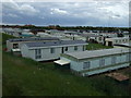
2
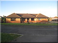
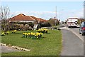
St. Barnabas Hospice Day Centre
At present closed.
Image: © Jonathan Thacker
Taken: 1 Jan 2013
0.05 miles
3
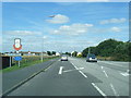
Trusthorpe Road, Sutton on Sea
View north west along Trusthorpe Road.
Image: © David P Howard
Taken: 2 Mar 2015
0.09 miles
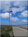
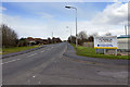
4
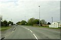
Trusthorpe Road leaving Sutton on Sea
Image: © Steve Daniels
Taken: 15 May 2016
0.11 miles
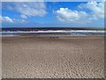
5
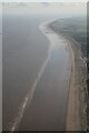
Coast from Trusthorpe to Sutton on Sea towards Skegness: aerial 2024
Image: © Chris
Taken: 25 Feb 2024
0.15 miles