IMAGES TAKEN NEAR TO
South Reston, LOUTH, LN11 8PJ
Introduction
This page details the photographs taken nearby to LN11 8PJ by members of the Geograph project.
The Geograph project started in 2005 with the aim of publishing, organising and preserving representative images for every square kilometre of Great Britain, Ireland and the Isle of Man.

There are currently over 7.5m images from over14,400 individuals and you can help contribute to the project by visiting https://www.geograph.org.uk
Image Map (Loading...)


Getting Data...Please wait
Leaflet Map data © OpenStreetMap
Images are licensed for reuse under creativecommons.org/licenses/by-sa/2.0
Notes
- Clicking on the map will re-center to the selected point.
- The higher the marker number, the further away the image location is from the centre of the postcode.
Image Listing (17 Images Found)
Images are licensed for reuse under creativecommons.org/licenses/by-sa/2.0
Image
Details
Distance
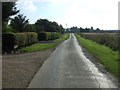
4
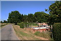
Building site by the vegetable garden by The Grove
Image: © Chris
Taken: 19 Jul 2013
0.10 miles
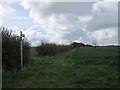
5
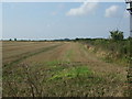
Stubble field and hedgerow
Off Willoughby Lane.
Image: © JThomas
Taken: 11 Sep 2015
0.10 miles
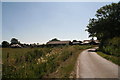
7
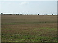
Stubble field near The Grove
Off Willoughby Lane.
Image: © JThomas
Taken: 11 Sep 2015
0.14 miles
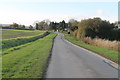
8
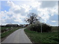
Willoughby Lane
Heading south near The Grove.
Image: © JThomas
Taken: 11 Sep 2015
0.14 miles
9
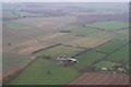
Willoughby Lane and Rats Pen Lane: aerial 2014
The area in the centre has been the subject of a successful Planning Application for a giant solar farm, which will involve intensive construction work and the transport of large numbers of photovoltaic panels and stands.
For aerial films of this area see: https://www.youtube.com/watch?v=wwhVamd4j6E and https://www.youtube.com/watch?v=zZjqzcMFXi8
These are LiDAR films of the Wolds and Marshes east of Louth. The films are narrated by Jim Broadbent. The land is colour-coded according to its elevation. The films show how the landscape was reclaimed for salt making and grazing. Footage includes ancient river systems, settlements, salterns and ridge and furrow. Produced for the Lincolnshire Coastal Grazing Marshes Project, which has now terminated.
Image: © Chris
Taken: 18 Nov 2014
0.16 miles
10
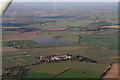
Solar installation under construction by Rats Pen Lane, Authorpe: aerial 2016
Planning permission was granted for this in 2014 - see Image and Image
Looking across Prosperity Farm.
Image: © Chris
Taken: 11 Feb 2016
0.17 miles