IMAGES TAKEN NEAR TO
Penmynydd Road, LLANGEFNI, LL77 7HR
Introduction
This page details the photographs taken nearby to Penmynydd Road, LL77 7HR by members of the Geograph project.
The Geograph project started in 2005 with the aim of publishing, organising and preserving representative images for every square kilometre of Great Britain, Ireland and the Isle of Man.

There are currently over 7.5m images from over14,400 individuals and you can help contribute to the project by visiting https://www.geograph.org.uk
Image Map
Images are licensed for reuse under creativecommons.org/licenses/by-sa/2.0
Notes
- Clicking on the map will re-center to the selected point.
- The higher the marker number, the further away the image location is from the centre of the postcode.
Image Listing (23 Images Found)
Images are licensed for reuse under creativecommons.org/licenses/by-sa/2.0
Image
Details
Distance
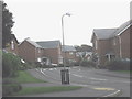
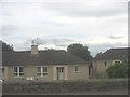
1
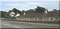
"Old folk's bungalows" in Penmynydd Road
Image: © Eric Jones
Taken: 21 Jul 2008
0.01 miles
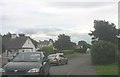
3
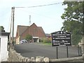
Eglwys Gatholig St Joseff Catholic Church, Penmynydd Road
This brick built church, served by the Irish OMI's, was built in 1970. It replaced an earlier church in Bridge Street which dated back to the war years.
Image: © Eric Jones
Taken: 21 Jul 2008
0.06 miles
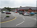
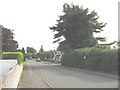
5
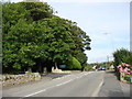
Entrance to the Pencraig campus of Coleg Menai FE in Penmynydd Road
Image: © Eric Jones
Taken: 21 Jul 2008
0.08 miles
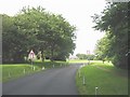
6
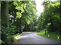
View south along the driveway of the Pencraig campus
Image: © Eric Jones
Taken: 21 Jul 2008
0.09 miles