IMAGES TAKEN NEAR TO
LLANGEFNI, LL77 7BQ
Introduction
This page details the photographs taken nearby to LL77 7BQ by members of the Geograph project.
The Geograph project started in 2005 with the aim of publishing, organising and preserving representative images for every square kilometre of Great Britain, Ireland and the Isle of Man.

There are currently over 7.5m images from over14,400 individuals and you can help contribute to the project by visiting https://www.geograph.org.uk
Image Map (Loading...)


Getting Data...Please wait
Leaflet Map data © OpenStreetMap
Images are licensed for reuse under creativecommons.org/licenses/by-sa/2.0
Notes
- Clicking on the map will re-center to the selected point.
- The higher the marker number, the further away the image location is from the centre of the postcode.
Image Listing (19 Images Found)
Images are licensed for reuse under creativecommons.org/licenses/by-sa/2.0
Image
Details
Distance
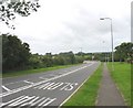
4
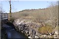
Afon Cefni
The disused railway line to Amlwch is on one side of the river, while the suspended walkway/cycle path is on the other.
Image: © Kevin Williams
Taken: 17 Apr 2010
0.13 miles
5
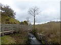
Boardwalk on the Lon Las Cefni
At this point, the Lon Las Cefni cycle route (part of National Cycle Network route 566) runs on a spectacular length of boardwalk cantilevered over the river.
Image: © Oliver Dixon
Taken: 8 Apr 2016
0.14 miles
6
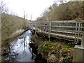
Boardwalk on the Lon Las Cefni
At this point, the Lon Las Cefni cycle route (part of National Cycle Network route 566) runs on a spectacular length of boardwalk cantilevered over the river.
Image: © Oliver Dixon
Taken: 8 Apr 2016
0.14 miles
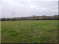
7
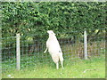
Adding some variety to the staple diet
In fact, sheep are very fond of trees, and will easily strip the bark and eat the leaves.
Image: © Eric Jones
Taken: 16 Jul 2008
0.14 miles
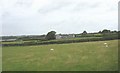
8
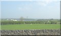
View across farmland towards the Cefni Reservoir dam
Image: © Eric Jones
Taken: 7 Apr 2008
0.15 miles
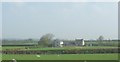
9
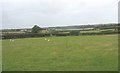
Farmland between the B 5109 and the Cefni Reservoir
Image: © Eric Jones
Taken: 16 Jul 2008
0.15 miles