IMAGES TAKEN NEAR TO
PENTRAETH, LL75 8DQ
Introduction
This page details the photographs taken nearby to LL75 8DQ by members of the Geograph project.
The Geograph project started in 2005 with the aim of publishing, organising and preserving representative images for every square kilometre of Great Britain, Ireland and the Isle of Man.

There are currently over 7.5m images from over14,400 individuals and you can help contribute to the project by visiting https://www.geograph.org.uk
Image Map (Loading...)


Getting Data...Please wait
Leaflet Map data © OpenStreetMap
Images are licensed for reuse under creativecommons.org/licenses/by-sa/2.0
Notes
- Clicking on the map will re-center to the selected point.
- The higher the marker number, the further away the image location is from the centre of the postcode.
Image Listing (34 Images Found)
Images are licensed for reuse under creativecommons.org/licenses/by-sa/2.0
Image
Details
Distance
1
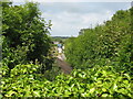
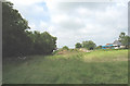
A glimpse of the line of the trackbed of the old railway from the A 5025 bridge
Image: © Eric Jones
Taken: 26 Jul 2008
0.03 miles
2
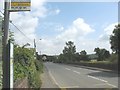
Parapet of the old bridge over the defunct railway on the A 5025 north of Pentraeth
The parapet on the opposite side of the road had disappeared as a result of road widening. The cutting leading to it from the south has also been infilled.
Image: © Eric Jones
Taken: 26 Jul 2008
0.03 miles
3
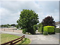
Private road to The Retreat seen across the A 5025
Image: © Eric Jones
Taken: 26 Jul 2008
0.04 miles
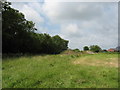
5
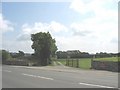
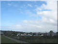
Infilled railway cutting on the Holland Arms-Red Wharf Bay line at Pentraeth
Here the railway ran in a cutting which was crossed by the A 5025 by means of a bridge. There is little evidence of the bridge nowadays on the west side of the road. The half hourly Amlwch to Bangor Arriva No 62 bus in the background is a reminder of the reason for the early demise of this railway.
Image: © Eric Jones
Taken: 26 Jul 2008
0.06 miles
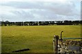
6
The infilled cutting between the footbridge and the A 5025
Image: © Eric Jones
Taken: 26 Jul 2008
0.07 miles
9
Access lane to the Clai Mawr Caravan Park
Image: © Eric Jones
Taken: 28 Mar 2009
0.09 miles
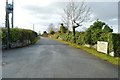
10
View north along a lane leading to the Clai Mawr caravan site
Image: © Eric Jones
Taken: 26 Jul 2008
0.09 miles