IMAGES TAKEN NEAR TO
TYN-Y-GONGL, LL74 8SA
Introduction
This page details the photographs taken nearby to LL74 8SA by members of the Geograph project.
The Geograph project started in 2005 with the aim of publishing, organising and preserving representative images for every square kilometre of Great Britain, Ireland and the Isle of Man.

There are currently over 7.5m images from over14,400 individuals and you can help contribute to the project by visiting https://www.geograph.org.uk
Image Map
Images are licensed for reuse under creativecommons.org/licenses/by-sa/2.0
Notes
- Clicking on the map will re-center to the selected point.
- The higher the marker number, the further away the image location is from the centre of the postcode.
Image Listing (16 Images Found)
Images are licensed for reuse under creativecommons.org/licenses/by-sa/2.0
Image
Details
Distance
2
Capel Tabernacl Chapel, Llanfair M.E.
This is a Calvinistic Methodist chapel. Llanfair M.E. is not a medical condition. It is short for Llanfair-Mathafarn-Eithaf (meaning "St Mary's church in the furthest field of the tavern"). which is the name of the parish in which Benllech is situated. The most famous son of the parish was the 18th century poet and beer-swilling cleric Goronwy Owen who was forced into exile in America by the English Bishop of Bangor
http://www.tourbrunswick.org/goronwy_owen.htm
Image: © Eric Jones
Taken: 1 Aug 2007
0.08 miles
3
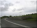
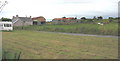
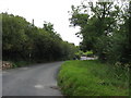
Junction with the B5108 west of Tyn-y-gongl
This view is taken from the minor leading south to Llabedrgoch and the A5025.
Image: © Eric Jones
Taken: 27 May 2009
0.08 miles
4
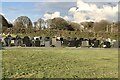
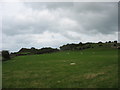
Mynwent Cyhoeddus, Benllech
Public cemetery (mynwent cyhoeddus); burial ground of Bwthyn Tabarnacl, Benllech.
Image: © David Dixon
Taken: 31 Mar 2022
0.09 miles
5
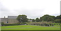
Capel Tabernacl, Llanfair-Mathafarn-Eithaf, Anglesey
A Calvinistic Methodist chapel in the Community of Llanfair-Mathafarn-Eithaf.
Image: © Keith Williamson
Taken: 1 May 2005
0.09 miles
6
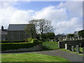
Mynwent Capel Tabernacl Chapel Cemetery, Llanfair M.E.
Image: © Eric Jones
Taken: 1 Aug 2007
0.10 miles
7
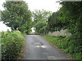
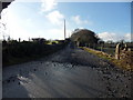
The back road to Benllech
This road is known as the Bwlch (=pass/gap) Road.
Image: © Eric Jones
Taken: 8 Sep 2008
0.13 miles
8
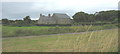
Loose Stones
Track to Ynys Isaf near Benllech.
Image: © J Scott
Taken: 19 Jan 2011
0.14 miles