
IMAGES TAKEN NEAR TO
Market Square, LLANNERCH-Y-MEDD, LL71 8BY
Introduction
This page details the photographs taken nearby to Market Square, LL71 8BY by members of the Geograph project.
The Geograph project started in 2005 with the aim of publishing, organising and preserving representative images for every square kilometre of Great Britain, Ireland and the Isle of Man.

There are currently over 7.5m images from over14,400 individuals and you can help contribute to the project by visiting https://www.geograph.org.uk
Image Map
Images are licensed for reuse under creativecommons.org/licenses/by-sa/2.0
Notes
- Clicking on the map will re-center to the selected point.
- The higher the marker number, the further away the image location is from the centre of the postcode.
Image Listing (53 Images Found)
Images are licensed for reuse under creativecommons.org/licenses/by-sa/2.0
Image
Details
Distance
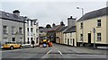
2
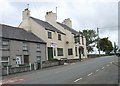
Twr Cyhelun Arms, Twr Cyhelun Street. Llannerch-y-Medd
Llannerch-y-Medd now only has two public houses - Twr Cyhelun Arms and The Bull Inn. In the 19th C, before the religious revival, the town lived up to its name (which means "glade of the mead") with a dozen or more public houses. Some of these were music taverns visited by itinerant Gypsy harpists and fiddlers, including members of the famous Abraham Wood family. Llannerch-y-Medd's most famous music pub at the time was the Britannia, located on the square. The father, John Jones, who had learnt the craft from the Woods, and his three sons were nationally known harpists. One son, Owen Jones (1860-1907) was harpist to the Royal Welsh Fusiliers and was frequently called upon to play to the Royal Family.
Image: © Eric Jones
Taken: 12 Jul 2008
0.01 miles
3
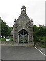
St Mary's lychgate from Market Square, Llanerchymedd
There is an Ordnance Survey benchmark to the right of the gate on St Mary's lychgate Image
Image: © John S Turner
Taken: 30 Aug 2015
0.03 miles
4
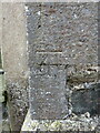
Benchmark on St Mary's lychgate, Llanerchymedd
Ordnance Survey benchmark on the west side of St Mary's lychgate. The mark is recorded on old maps levelled at 222.8 feet above Liverpool Datum. For a wider view see Image
Benchmark Database: https://www.bench-marks.org.uk/bm35364
Image: © John S Turner
Taken: 30 Aug 2015
0.03 miles
5
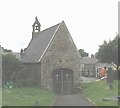
The lych gate of St Mary's Church
This lych gate is bigger than many Anglesey churches. It was built in 1755. It overlooks the town's square.
Image: © Eric Jones
Taken: 12 Jul 2008
0.04 miles
7
Sgwar Llan. The Central Square at Llannerch-y-Medd
This for centuries has been the place to hang-out.
Image: © Eric Jones
Taken: 12 Jul 2008
0.04 miles
8
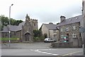
The Church of St Mary, the lych gate and the old rectory viewed across the town square
Image: © Eric Jones
Taken: 12 Jul 2008
0.04 miles
10
Approaching The Roundabout, Llanerchymedd
Image: © Peter Whatley
Taken: 5 Aug 2009
0.05 miles