IMAGES TAKEN NEAR TO
DULAS, LL70 9DX
Introduction
This page details the photographs taken nearby to LL70 9DX by members of the Geograph project.
The Geograph project started in 2005 with the aim of publishing, organising and preserving representative images for every square kilometre of Great Britain, Ireland and the Isle of Man.

There are currently over 7.5m images from over14,400 individuals and you can help contribute to the project by visiting https://www.geograph.org.uk
Image Map
Images are licensed for reuse under creativecommons.org/licenses/by-sa/2.0
Notes
- Clicking on the map will re-center to the selected point.
- The higher the marker number, the further away the image location is from the centre of the postcode.
Image Listing (15 Images Found)
Images are licensed for reuse under creativecommons.org/licenses/by-sa/2.0
Image
Details
Distance
1
Gorse covered knoll at Bryniau Teici farm
Image: © Eric Jones
Taken: 17 Jan 2009
0.11 miles
2
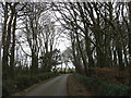
Bend in the road near Bryniau Tecaf Farm
Bryniau Tecaf means "fairest hills".
Image: © Eric Jones
Taken: 17 Jan 2009
0.13 miles
3
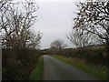
The backroad between Penygraigwen and Llaneuddog west of Deri-isaf
Image: © Eric Jones
Taken: 17 Jan 2009
0.15 miles
4
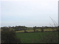
View across farmland towards Bryniau Tecaf
Image: © Eric Jones
Taken: 17 Jan 2009
0.15 miles
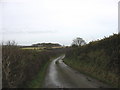
5
Approaching the minor road junction near Deri-isaf
Image: © Eric Jones
Taken: 17 Jan 2009
0.17 miles
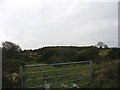
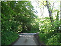
6
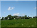
View across meadow land towards Deri-isaf
Deri-isaf offers high class holiday accommodation and is also the home of the DeriMon Smokery.
http://www.angleseyfarms.com/deri.htm
http://www.derimonsmokery.co.uk/
Image: © Eric Jones
Taken: 29 May 2009
0.18 miles
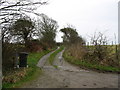
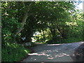
7
The entrance drive to Deri Isaf
Image: © Eric Jones
Taken: 17 Jan 2009
0.18 miles
8
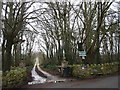
The entrance to Deri-isaf Country House and the Deri Mon Smokery
Image: © Eric Jones
Taken: 29 May 2009
0.18 miles
9
Minor road junction
Image: © Eric Jones
Taken: 29 May 2009
0.19 miles