IMAGES TAKEN NEAR TO
PENYSARN, LL69 9UH
Introduction
This page details the photographs taken nearby to LL69 9UH by members of the Geograph project.
The Geograph project started in 2005 with the aim of publishing, organising and preserving representative images for every square kilometre of Great Britain, Ireland and the Isle of Man.

There are currently over 7.5m images from over14,400 individuals and you can help contribute to the project by visiting https://www.geograph.org.uk
Image Map
Images are licensed for reuse under creativecommons.org/licenses/by-sa/2.0
Notes
- Clicking on the map will re-center to the selected point.
- The higher the marker number, the further away the image location is from the centre of the postcode.
Image Listing (4 Images Found)
Images are licensed for reuse under creativecommons.org/licenses/by-sa/2.0
Image
Details
Distance
1
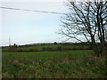
View across grazing land to houses on the Gadfa road
Image: © Eric Jones
Taken: 17 Jan 2009
0.08 miles
2
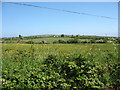
View north-eastwards to houses on the Gadfa road
Image: © Eric Jones
Taken: 29 May 2009
0.10 miles
3
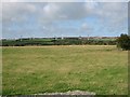
Farming Diversification
Sheep and wind farming seen from the minor road between Capel Parc and Gadfa.
Image: © Roger Gilbertson
Taken: 1 Sep 2006
0.14 miles