
IMAGES TAKEN NEAR TO
Rhosybol, AMLWCH, LL68 9UA
Introduction
This page details the photographs taken nearby to LL68 9UA by members of the Geograph project.
The Geograph project started in 2005 with the aim of publishing, organising and preserving representative images for every square kilometre of Great Britain, Ireland and the Isle of Man.

There are currently over 7.5m images from over14,400 individuals and you can help contribute to the project by visiting https://www.geograph.org.uk
Image Map
Images are licensed for reuse under creativecommons.org/licenses/by-sa/2.0
Notes
- Clicking on the map will re-center to the selected point.
- The higher the marker number, the further away the image location is from the centre of the postcode.
Image Listing (22 Images Found)
Images are licensed for reuse under creativecommons.org/licenses/by-sa/2.0
Image
Details
Distance
1
Bwthyn Daisy on the lane north to Four Crosses, Rhosybol
Image: © Eric Jones
Taken: 11 May 2009
0.01 miles
2
Pen-yr-orsedd Farm, Ty-newydd and Bwthyn Daisy from the bend at Dafarn Dyweirch
Image: © Eric Jones
Taken: 11 May 2009
0.03 miles
4
Sharp bend in the Rhosgoch to Llanerch-y-medd road near Dafarn Dyweirch
The minor road in the foreground leads to Four Crosses. The new bungalow on the right occupies the site, and retains the name, of a former tavern known as Dafarn Dyweirch (= turfs' tavern). The tavern would have been roofed with turfs, hence the name.
Image: © Eric Jones
Taken: 11 May 2009
0.06 miles
5
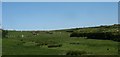
Valley of one of the headwaters of Afon Alaw
The stream drains south-westwards towards the Llyn Alwen reservoir.
Image: © Eric Jones
Taken: 11 May 2009
0.07 miles
6
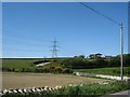
The Z-bend between Dafarn Dyweirch and Pen-yr-orsedd
Image: © Eric Jones
Taken: 11 May 2009
0.07 miles
7
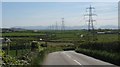
The winding road towards Llanerch-y-medd from beyond Pen-yr-orsedd
Image: © Eric Jones
Taken: 11 May 2009
0.09 miles
8
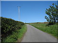
Road north towards Four Crosses, Rhosgoch
Image: © Eric Jones
Taken: 11 May 2009
0.10 miles
9
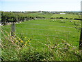
Farmland east of the Four Crosses road
The village of Rhosybol can be seen in the background
Image: © Eric Jones
Taken: 11 May 2009
0.11 miles
10
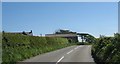
Approaching Pen-yr-orsedd farm, Rhosgoch
Image: © Eric Jones
Taken: 17 May 2009
0.12 miles