IMAGES TAKEN NEAR TO
AMLWCH, LL68 9PB
Introduction
This page details the photographs taken nearby to LL68 9PB by members of the Geograph project.
The Geograph project started in 2005 with the aim of publishing, organising and preserving representative images for every square kilometre of Great Britain, Ireland and the Isle of Man.

There are currently over 7.5m images from over14,400 individuals and you can help contribute to the project by visiting https://www.geograph.org.uk
Image Map
Images are licensed for reuse under creativecommons.org/licenses/by-sa/2.0
Notes
- Clicking on the map will re-center to the selected point.
- The higher the marker number, the further away the image location is from the centre of the postcode.
Image Listing (9 Images Found)
Images are licensed for reuse under creativecommons.org/licenses/by-sa/2.0
Image
Details
Distance
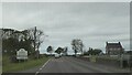
5
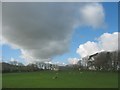
Llaethdy-mawr farmhouse, Cerrig-man
Llaethdy-mawr (=big dairy) is also a registered caravan site.
Image: © Eric Jones
Taken: 11 Apr 2009
0.13 miles
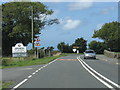
7
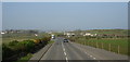
The A5025 near Parc-mawr Farm
The farmhouse can be seen to the right of the road.
Image: © Eric Jones
Taken: 20 Mar 2009
0.15 miles
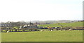
8
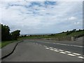
Pasture land east of Llaethdy
The view extends northwards over the town of Amlwch to the Irish Sea.
Image: © Eric Jones
Taken: 23 May 2009
0.19 miles
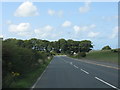
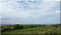
9
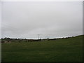
Power lines heading north-eastwards towards Amlwch town
Image: © Eric Jones
Taken: 11 Mar 2009
0.24 miles