
IMAGES TAKEN NEAR TO
Tyddyn Bach, CEMAES BAY, LL67 0LJ
Introduction
This page details the photographs taken nearby to Tyddyn Bach, LL67 0LJ by members of the Geograph project.
The Geograph project started in 2005 with the aim of publishing, organising and preserving representative images for every square kilometre of Great Britain, Ireland and the Isle of Man.

There are currently over 7.5m images from over14,400 individuals and you can help contribute to the project by visiting https://www.geograph.org.uk
Image Map
Images are licensed for reuse under creativecommons.org/licenses/by-sa/2.0
Notes
- Clicking on the map will re-center to the selected point.
- The higher the marker number, the further away the image location is from the centre of the postcode.
Image Listing (110 Images Found)
Images are licensed for reuse under creativecommons.org/licenses/by-sa/2.0
Image
Details
Distance
1
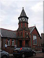
The David Hughes Village Hall
A view looking to the west across High Street towards the David Hughes Village Hall.
Image: © Phil Williams
Taken: 20 Apr 2006
0.08 miles
2
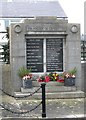
The War Memorial, Cemaes
Yn Anghof Ni Chant Fod (Forgotten they shall not be) - We Will Remember Them.
Amongst the names listed is that of Pilot Officer (Air Gunner) Vivian W.Parry, D.F.C, RAFVR, the son of David and Myfanwy Parry of Cemlyn, who died 5th September, 1942. His grave can be seen in an image taken by Archie Harris Image
Image: © Eric Jones
Taken: 30 Dec 2008
0.11 miles
3
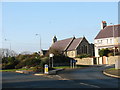
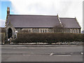
Eglwys St Padrig / St Patrick's Church, Cemaes
This church, built in 1865 to a design of Henry Kennedy, stands at the western end of the village. There is no burial ground associated with the church and Cemaes Anglicans are still buried at the mother church at Llanbadrig, a mile north-east of the village Image
Image: © Eric Jones
Taken: 9 Jan 2009
0.11 miles
4
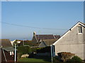
View across gardens towards St Patrick's Church, Cemaes
Image: © Eric Jones
Taken: 9 Jan 2009
0.11 miles
5
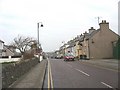
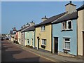
View northwards along the High Street, Cemaes
Image: © Eric Jones
Taken: 30 Dec 2008
0.12 miles
7
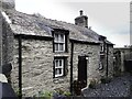
Ty Cefn
* Early C19 cottage. The Tithe Map of Llanbadrig, 1844, shows a number of rectangular buildings along what is now Cemaes Bay High Street, and also a building set back from the road on what looks to be the site of the cottage. Cefn is not mentioned by name in the tithe schedule, but 'Ty Cefn' is listed in the census returns for the parish, 1841; being the home of Edward Owen, agricultural labourer, and his wife Elizabeth.
* Courtesy British Listed Buildings.
Image: © Arthur C Harris
Taken: 4 Oct 2021
0.12 miles
10
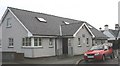
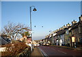
Meddygfa Cemaes Surgery, High Street, Cemaes
Image: © Eric Jones
Taken: 30 Dec 2008
0.13 miles