
IMAGES TAKEN NEAR TO
Roe Buck Estate, HOLYHEAD, LL65 4YR
Introduction
This page details the photographs taken nearby to Roe Buck Estate, LL65 4YR by members of the Geograph project.
The Geograph project started in 2005 with the aim of publishing, organising and preserving representative images for every square kilometre of Great Britain, Ireland and the Isle of Man.

There are currently over 7.5m images from over14,400 individuals and you can help contribute to the project by visiting https://www.geograph.org.uk
Image Map
Images are licensed for reuse under creativecommons.org/licenses/by-sa/2.0
Notes
- Clicking on the map will re-center to the selected point.
- The higher the marker number, the further away the image location is from the centre of the postcode.
Image Listing (25 Images Found)
Images are licensed for reuse under creativecommons.org/licenses/by-sa/2.0
Image
Details
Distance
1
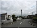
Lon Roebuck Estate, Llanfachraith/Llanfachreth
Image: © Eric Jones
Taken: 20 Jun 2009
0.03 miles
2
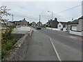
Llanfachraeth
The A5025 through the village, Wynnstay Stores to the left
Image: © Eirian Evans
Taken: 18 Jun 2015
0.07 miles
3
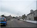
A5025 through Llanfachraeth
Looking towards Amlwch. Wynnstay stores can be seen to the left behind the blue car
Image: © John Firth
Taken: 3 Oct 2011
0.07 miles
5
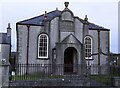
Abarim Chapel (Welsh Calvinistic Methodist)
Abarim Methodist Chapel was built in 1862 in the Simple Round-Headed and Arts and Craft style of the short-wall entry type. The chapel was renovated in 1908.
Image: © Arthur C Harris
Taken: 24 Apr 2021
0.11 miles
6
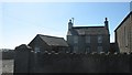
Ty Capel Abarim, Llanfachraith/Llanfachraeth
The Calvinist Capel Abarim stands in the centre of the village of Llanfachraith, with the chapel house on its south side. The present chapel and house date from the 1860s.
Image: © Eric Jones
Taken: 11 Apr 2009
0.12 miles
7
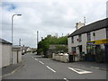
The Llanddeusant road at Llanfachraith/Llanfachreth
Image: © Eric Jones
Taken: 20 Jun 2009
0.12 miles
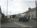
9
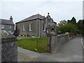
Capel Abarim, Llanfachraeth
Early C20 Methodist chapel, dated 1908 on the name plaque above entrance. It was built to replace the earlier chapel on the site which, according to a slate plaque above the side entrance was erected in 1860. It is a Grade II listed building and still in use as a chapel.
Image: © Eirian Evans
Taken: 18 Jun 2015
0.12 miles
10
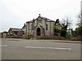
Abarim Methodist Chapel
The Grade II listed https://www.coflein.gov.uk/en/site/8733/details/abarim-chapel-welsh-calvinistic-methodist-llanfachraeth Abarim Methodist Chapel was built in 1862 in the Simple Round-Headed and Arts and Craft style of the short-wall entry type. The chapel was renovated in 1908.
Image: © Gerald England
Taken: 20 Mar 2019
0.12 miles