
IMAGES TAKEN NEAR TO
Llanfachraeth, HOLYHEAD, LL65 4NG
Introduction
This page details the photographs taken nearby to LL65 4NG by members of the Geograph project.
The Geograph project started in 2005 with the aim of publishing, organising and preserving representative images for every square kilometre of Great Britain, Ireland and the Isle of Man.

There are currently over 7.5m images from over14,400 individuals and you can help contribute to the project by visiting https://www.geograph.org.uk
Image Map
Images are licensed for reuse under creativecommons.org/licenses/by-sa/2.0
Notes
- Clicking on the map will re-center to the selected point.
- The higher the marker number, the further away the image location is from the centre of the postcode.
Image Listing (11 Images Found)
Images are licensed for reuse under creativecommons.org/licenses/by-sa/2.0
Image
Details
Distance
1
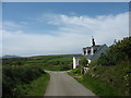
Penrhos Cottage
This cottage stands on the western slope of the drumlin and has a view extending west towards Holyhead Mountain.
Image: © Eric Jones
Taken: 3 May 2009
0.02 miles
3

Graianfryn
A view looking east down the slope towards the buildings of Graianfryn farm at left.
Image: © Phil Williams
Taken: 18 Apr 2006
0.08 miles
5

Triangulation pillar above Stryd y Facsen
This pillar is situated on the summit of a drumlin at a height of 44m above sea-level
Image: © Eric Jones
Taken: 3 May 2009
0.10 miles
6

Field edge footpath passing Graianfy Triangulation Pillar
Looking south-westward.
Image: © Peter Wood
Taken: 5 Dec 2017
0.11 miles
7

Approaching trig. pillar 44
From here the polythene covered drumlin slope at Llanynghenedl resembles an airfield runway.
Image: © Eric Jones
Taken: 3 May 2009
0.12 miles
8
Climbing road west of Graianfryn
The lane running west towards the A5025 here climbs over a drumlin.
Image: © Eric Jones
Taken: 3 May 2009
0.12 miles
9
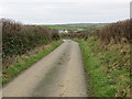
Hedge enclosed lane to Graianfryn
Looking eastward.
Image: © Peter Wood
Taken: 5 Dec 2017
0.15 miles
10
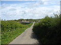
View downhill in the direction of Graianfryn Farm
The name Grianfryn means "gravel hill".
Image: © Eric Jones
Taken: 3 May 2009
0.21 miles