
IMAGES TAKEN NEAR TO
Rhydwyn, HOLYHEAD, LL65 4HA
Introduction
This page details the photographs taken nearby to LL65 4HA by members of the Geograph project.
The Geograph project started in 2005 with the aim of publishing, organising and preserving representative images for every square kilometre of Great Britain, Ireland and the Isle of Man.

There are currently over 7.5m images from over14,400 individuals and you can help contribute to the project by visiting https://www.geograph.org.uk
Image Map
Images are licensed for reuse under creativecommons.org/licenses/by-sa/2.0
Notes
- Clicking on the map will re-center to the selected point.
- The higher the marker number, the further away the image location is from the centre of the postcode.
Image Listing (77 Images Found)
Images are licensed for reuse under creativecommons.org/licenses/by-sa/2.0
Image
Details
Distance
1

Campsite above Church Bay / Porth Swtan
Porth Swtan gets its name from the thatched whitewashed building seen here adjacent to this campsite, a rare survivor and the last thatched building on Anglesey, called Swtan. The campsite is ideally located next to coastal paths and a short walk from the sandy bay.
Image: © Jeremy Bolwell
Taken: 10 Apr 2011
0.06 miles

3

Caerau, Porth Swtan - a period cottage
Unlike the thatched Bwthyn Swtan, Caerau is a private residence. It can best be seen from the Anglesey Coastal Path.
Image: © Eric Jones
Taken: 26 Jun 2009
0.09 miles

5
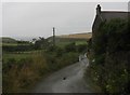
Private road to Porth Crugmor
Public rights of way for walkers exist along this road.
Image: © Eric Jones
Taken: 4 Jul 2009
0.13 miles
6

Gate on the Isle of Anglesey Coast Path
This gate takes walkers around this section of the coastal path.
Image: © Jeremy Bolwell
Taken: 10 Apr 2011
0.14 miles
7

The Last Thatched Cottage on the Isle of Anglesey
Swtan, the last thatched cottage on the Isle of Anglesey is now a Folk Museum, and is beautifully restored.
Image: © Stephen Elwyn RODDICK
Taken: 9 Apr 2002
0.15 miles

9

A geo at the southern end of Porth Tyddyn-uchaf
Image: © Eric Jones
Taken: 26 Jun 2009
0.16 miles
10

The northern section of Porth Tyddyn-uchaf
Porth Tyddyn-uchaf means "upper homestead cove".
Image: © Eric Jones
Taken: 26 Jun 2009
0.16 miles